Khandwa
Author: Laxman Burdak IFS (R) |
- For another villages of same name see - Khandwa Niwai/Khandwa Churu/Khandwa Sehore


Khandwa (खंडवा) is a city and district in Madhya Pradesh. Formerly it was called East Nimar. It is located on Abna River. Burhanpur District was created on August 15, 2003, from the southern portion of Khandwa District.
Variants
Origin of name
- The name of the city is derived from Khandavavana (खांडववन), which literally means Khandav Forests.
- To trace the origin of the name of the present District it is necessary first to find out the origin of the name Prant Nimar from which obviously most of the present District is carved. Nothing definite is known about the latter but it may be guessed that the old Prant Nimar was so called, because a place called Nimawar on the Narmada (now in Dewas District), was the capital of Prant Nimar. Nimawar is also mentioned by the famous Arab writer Alberuni, as Namavur[1]. The name Nimar happens to be spelt in certain books as Nimaur.[2] In course of time and by stages Nimawar, Namavur or Nimaur may have assumed the simple form, Nimar. As most of the territorial divisions derive their names from some one place of importance in the region, and as Nimawar was such a place of religion and administrative importance in the region,[3] the old Prant Nimar was called after that name, and the present Nimar District carved out of it retained the same.[4]
- The name is supposed to be derived from nim, half, as Nimar was supposed to be half-way down the course of the Narmada, but in reality it is much nearer the mouth than the source of the river.[5]
- Another derivation suggested is from the nim tree which is noticeably common in the District” [6] . [7]
Location
Khandwa is a major railway junction; the Malwa line connecting Indore with the Deccan meets the main east–west line from Mumbai to Kolkata.
The Town Khandwa has the proud to be the Head Quarter of District East Nimar. Due to its location on the map of India, it has been enjoying visits of great Indians. In the past (age of British Government), this was a place alone connecting northern, eastern, southern and western rail routes. Delhi (North) and Bombay (South) and Baroda (West) was directly connected whereas Calcutta was accessible through Bhusawal Junction.
Swami Dayananda Saraswati, Swami Vivekananda, Mahatma Gandhi, Lokmanya Tilak and many more great personalities visited the place during there all India visit. The Location, easy availability of resources and other socio-economic factors are in favour of making the place a very good Industrial region.The place has several ancient kunds., English architecture and religious places.
The place is located at Bombay-Delhi central line and north of Burhanpur. The place has been the district Head quarter since 1864. The place has four historic kunds in its four direction namely Suraj kunda, Padma kund, Bhima kunda, Rameshwar kund. The buildings of Collector office, Girls Degree College, Ghantaghar are Among the ancient monuments. Dada Dhuni wale ki samadhi, Turja Bhavani Temple, Nav-chandi Devi Dham are the places of faith & worship of Hindus.
Source - https://khandwa.nic.in/en/tourist-place/khandwa-town/
Author's Visit
Author (Laxman Burdak) stayed at Khandwa (30.01.1995 – 17.01.1997) when posted as Conservator of Forests, Compensatory Afforestation and Catchment Area Treatment Circle, Narmada Valley Development Authority, Khandwa.
Tahsils in Khandwa District
Villages in Khandwa tahsil
Town :1. Khandwa
Villages:
1 Ahmadpur, 2 Ajanti, 3 Amalpura, 4 Ambapat, 5 Amlani, 6 Amoda, 7 Atoot Bhikari, 8 Attar, 9 Awaliya Vithal, 10 Badgaon Bhila, 11 Badgaon Gujar, 12 Badgaon Mal, 13 Badgaon Mali, 14 Badgaon Piplod, 15 Badiya Tula, 16 Baidiya Khurd, 17 Baidiyaw, 18 Baldua Dongri, 19 Baliyapura, 20 Balkhand Sura, 21 Balwada, 22 Bamanda Ryt, 23 Bamangaon, 24 Bamangaon Bhila, 25 Bamjhar, 26 Banjari, 27 Barar, 28 Barud, 29 Bawadiyakajee, 30 Benpura Kurwada, 31 Bhagaiyapur, 32 Bhagwanpura, 33 Bhaisawan, 34 Bhakarada, 35 Bhamgarh Nazul, 36 Bhandariya, 37 Bhawsinghpura, 38 Bhelkhedi, 39 Bhigawan Nankari, 40 Bhil Khedi Murar, 41 Bhilai Kheda, 42 Bhojakhedi, 43 Bhuifal, 44 Bhutni Ryt, 45 Bihar, 46 Bijora Bhil, 47 Bilan Kheda, 48 Birpur Kundeshwar, 49 Bisrampur Ryt, 50 Bodul, 51 Borgaon Khurd, 52 Borkheda Kalan, 53 Borkheda Khurd Ryt, 54 Chandpur Ryt, 55 Charkheda, 56 Chhaigaon Devi, 57 Chhaigaon Makhan, 58 Chhanera, 59 Chhirbel, 60 Chhirwan Ryt, 61 Chich Kheda, 62 Chichgohan, 63 Chichli Buzurg, 64 Dagadiya, 65 Deepla, 66 Dehariya, 67 Delgaon, 68 Deola Mafi, 69 Deshgaon, 70 Dewla Mafi, 71 Dhangaon, 72 Dhangaon, 73 Dhanora, 74 Dharampuri, 75 Dhodwada, 76 Dhorani, 77 Digarish, 78 Dodwada, 79 Domwada, 80 Dongargaon, 81 Dugwada, 82 Fatepur Mundi, 83 Fathehpur, 84 Fulgaon, 85 Gajwada, 86 Gandhwa, 87 Garangaon, 88 Gohlari, 89 Gokulgaon, 90 Golkheda Ryt, 91 Gondwadi, 92 Gondwadi Ryt, 93 Gudikheda Ryt, 94 Gujrikheda Ryt, 95 Haidarpur, 96 Handiakheda Ryt, 97 Hapla, 98 Haraswada, 99 Heerapur, 100 Hirapur Ryt, 101 Itwa Ryt, 102 Itwamal, 103 Jagatpura, 104 Jalkuwa, 105 Jamli Mundi, 106 Jamli Sayad, 107 Jamniya, 108 Jaswadi, 109 Jawar, 110 Jheeraniya, 111 Jinwaniya, 112 Jirwan, 113 Kahalari, 114 Kaldakhedi, 115 Kalmukhi, 116 Kalpat, 117 Kamaliya, 118 Kankariya, 119 Kanwani, 120 Karpur Ryt, 121 Kaweshwar, 122 Kedarkhedi, 123 Kesoon, 124 Khajuri, 125 Kharkali, 126 Khedi Kitta, 127 Khidgaon, 128 Khutpal, 129 Kirgaon, 130 Kithiya Joshi, 131 Kohadad, 132 Kolgaon, 133 Korgala, 134 Kotwada, 135 Kumtha, 136 Lachhora Khurd, 137 Lachhorakalan, 138 Ladanpur, 139 Lakhangaon, 140 Lalwada, 141 Lohari, 142 Lunhar Ryt, 143 Machhoundi Ryt, 144 Malgaon, 145 Manpura, 146 Mathani Buzurg, 147 Mathani Khurd Ryt, 148 Mathela, 149 Matpur, 150 Moghat, 151 Mordad, 152 Mundwada, 153 Nagchoon, 154 Nahalda, 155 Nahar Mal, 156 Nandiya, 157 Nawali, 158 Pachhaha, 159 Padlya, 160 Palasi, 161 Palkana, 162 Panchbedi Ryt, 163 Pangra, 164 Panjhariya, 165 Parethi, 166 Pipalkota, 167 Piplod Khas, 168 Piplya Kalan, 169 Piplya Khurd Ryt, 170 Piplya Punasa, 171 Piplya Tahar, 172 Piplyafool, 173 Pokhar Kalan, 174 Puranpura Mal, 175 Puranpura Ryt, 176 Rahemapur, 177 Raikhutwal, 178 Rajgarh, 179 Rampurakalan, 180 Rampuri Ryt, 181 Rangaon, 182 Ranjani Ryt, 183 Rewada, 184 Rijgaon, 185 Rohani, 186 Rohnai, 187 Roshiya, 188 Roshnai, 189 Rudhy, 190 Sahejala, 191 Sahejalakhandwa, 192 Sali Ryt, 193 Sarai, 194 Saray, 195 Satwada, 196 Sawkheda, 197 Semalya Ryt, 198 Sihada, 199 Singot, 200 Sirpur, 201 Sirra, 202 Sirsod, 203 Siwana, 204 Sonud, 205 Sulyakhedi, 206 Sunderbel, 207 Surgaon Banjari, 208 Surgaon Joshi, 209 Surgaon Nipani, 210 Surgaon Rathor, 211 Sutarkheda Ryt, 212 Takali Mori, 213 Takalkheda Ryt, 214 Talwadiya, 215 Talwadiya, 216 Teerandajpur, 217 Tembhikalan, 218 Tighariya, 219 Titgaon, 220 Tokar Kheda, 221 Torani,
Source - https://www.census2011.co.in/data/subdistrict/3716-khandwa-east-nimar-madhya-pradesh.html
Archaeology
Source - East Nimar District Gazeteer by P N Shrivastav, 1969, p.37
Recent explorations in the beds of the Agni, Kundala, Machikunda, Chhota Tawa, Samdeni, Ruprel and Ghorapachhar, all tributaries of the Narmada, have revealed traces of the Palaeolithic men in East Nimar District.1 Palaeolithic tools have been discovered at Bijalpur, Barakund, Mahalkheri, Matupur and other places in Harsud tahsil. Microliths, consisting of blades, lunates, crescents and scrapers, and fluted cores have also been discovered in the above mentioned river valleys at Punaghat-Kala, Borkheda-Khurd, Peeplya-Bawli, Roshini and a large number of other villages in Harsud tahsil and at Dehgaon, Hutiya, Atud Khasa, Ratanpur, Nandh-kheda and other places, in Khandwa tahsil.2 Further explorations in East Nimar and adjoining district confirm the three-cycle hypothesis of De Terra and Patterson, the sequence of deposits being: Large-sized pebble-gravel, red sandy clay and the midium-sized pebble-gravel containing Middle Stone Age tools with fossils; finer gravel with thin flake-blade and scraper industry; and alluvium. 3
Lately, a proto-historic site, situated on the Tapti, 5 miles south-west of Burhanpur, has, in addition to microliths, yielded red-ware with black painting, black and red and red-slipped wares, grey-ware with light-cream slip and dull grey ware.
1. Indian Archaeology—A Review, 1958-59, p. 28; 1959-60, p. 69; 1960-61, p. 61.
2. Ibid.
3. Ibid, 1962-63, p. 10.
Inscriptions in East Nimar
Source - East Nimar District Gazeteer by P N Shrivastav, 1969, p.47-48
[p.47]: Of the several inscriptions found in the District, the oldest was discovered at Mandhata, being dated in 1055 A.D. It records the grant of a village to the Brahmanas of Amareshwara, a temple on the left bank of the Narmada at Mandhata, for food and other purposes by Jayasimhadeva, (C. 1055-60 A.D.), successor of Bhoja. 2 Malwa was invaded by Somesvara II of the later Chalukyas and Karna of Gujarat. In the battle that followed, Jayasimha was slain and Malwa was occupied by the invaders, but it did not remain in their possession for long. Udayaditya (C. 1060-90 A.D.), a brother or cousin of Bhoja, drove them out of Malwa. His dominions extended upto Nimar District to the south. 3 Shortly after A.D. 1143, the whole of Malwa was annexed to the kingdom of Gujarat. For the next twenty years the princes of the Paramara dynasty, designated as the Mahakumaras, ruled the Bhopal region and the district of Nimar, Hoshangabad and Khandesh as petty rulers. Sometime in the seventies of the twelfth Century, the Vindhyavarman recovered Malwa from the Chalukyas. 4
Two inscriptions of the reign of Devapaladeva (C. 1218-32), were found at Harsauda (modern Harsud) and Mandhata. Harsud Stone Inscription, dated in V. S. 1275 (A.D. 1218), records construction of a Siva temple and a tank nearby by a merchant and states that Devapaladeva of Dhar was the then ruler.6 Another inscription dated in V.S. 1282 (A.D. 1225), with the name of this king was found near the Siddhesvara temple at Mandhata. It records grant of a village Satajuna, still existing under the same name 13 miles south-west of Mandhata, to a number of Brahmanas after the king had bathed in the Reva (Narmada), while staying at Mahishmati which, as discussed in detail earlier, is equated with Mandhata. Inscription records not only names of the donees but also name of father, grandfather, place of origin, gotra and sakha, epithet used by each one
1. Ibid, pp. 95-96; The Struggle for Empire, pp. 68-71.
2 Epigraphia Indica, Vol. Ill, pp, 46, ff; Hiralal, Inscriptions in the C. P. and Berar. p. 74
3. The Struggle for Empire, p. 68.
4. Ibid, p. 70.
5. Indian Antiquary, Vol. XX, pp. 310-11; Journal, Asiatic Society of Bengal, Vol. XXVIII, pp. 1 to 8; Inscriptions in the C. P. and Berar, p. 77.
[p.48]: of them. The donees were connected with far-flung places of the country like Mathura, Jodhpur, Tripuri, Akola, the country between the Himalayas, etc.
The list of donees reveals an interesting feature. In case of 20 out of 32 donees, the same epithet is borne by grandfather, father and son; in 7 cases the grandfather and father have the same epithet, but the son has a different one; and in one case the epithet of father and son is the same while that of grand-father differs. In the four remaining cases we have the sequence: Dikshit, Awasthi, Shukla, Upadhyaya, Agnihotri, and the like. It is revealing, for it shows that the family names were not still stereotyped in the families since the donee and his father and grandfather have not the same distinctive designations or epithets.1
The remaining two inscriptions, both of which are on copper-plates and discovered at Mandhata, refer themselves to the reign of Jayasimhadeva alias Jayavarman (C. 1255-75), described as lord of Dhara. The first of these, dated in V. S. 1317 (A.D. 1261), records grant of a village Vadauda (the village Burud, 22 miles from Mandhata), in Mahuada pathak (Mohod, 28 miles from Mandhata), by Pratihara Gangeyadeva to three Brahmanas after bathing at the confluence of the Reva and the Kapila, near Amaresvara temple. This charter was later ratified by Jayavarman while he was staying at Mandu.2
The other one, dated in V.S. 1331 (A.D. 1274), is a charter issued by Sadhanika (a commander of the army), Anayasimhadeva, with the permission of the Paramara king Jayavarman, granting four villages to a number of Brahmanas residing in the Brahmapuri (i.e. the Brahmana settlement at Mandhata).3 It is evident from these inscriptions that the north of East Nimar was under the sway of the Paramaras from the beginning of the ninth to the last quarter of the thirteenth Centuries.
For details see Nimar District Inscriptions
(101) Padma Kund Inscriptions at Khandwa of year 1128 AD
[p.72]: Padma Kund is a tank on the western side of the Khandwa town. Here there are six inscriptions on the roofs of some small niches in the side-walls of the tank. The one on the northern side wall gives the name of Sri Padmanabha, to whom it appears a temple was dedicated
[p.73]: and from whose ruins these niches were taken and used in repairing the Padma Kund. On the western wall of the tank there are three and on the southern two inscriptions, four of which are dated in Samvat 1185 or A. D. 1128. Three of them mention the name of Sodhadeva (सोढ़देव), who was probably the builder of the Padmanabha or Padmesvara Temple. These records give the names of gods which were enshrined in the niches. One nich was meant for Trivikrama, another for Madhusudana, a third for Vishnu, and so on. It appears that the temples were all Vishnuite.
(Cunningham's Archaeological Reports, Volume IX, pages 113 and 114.)
Wiki editor Notes:
- Sodh (सोढ) (Jat clan) - Sodhadeva (सोढ़देव). Sodhadeva (सोढ़देव) was probably the builder of the Padmanabha or Padmesvara Temple of Khandwa mentioned in (101) Padma Kund Inscriptions at Khandwa of year 1128 AD.[8]
(102) Khandwa Gun Inscriptions of year 1554, 1589
[p.73]: Three iron guns, apparently brought from either Asirgadh or Burhanpur, now in the public gardens, bear inscriptions giving the names of the Faruqi kings Mubarik and Adil Shah. One is dated in the Hijri year 962 (1554-55 A.D.), and mentions the name of Mubarik Shah Faruqi. Another appears to be dated in Hijri year (9)98 (A. D. 1589) and evidently refers to the reign of Adil Shah alias Raja Ali Khan. The third is very illegible.
History
Ancient history: Recent explorations in the beds/tributaries of Narmada have revealed traces of the Paleolithic men in the East Nimar district. Omkar Mandhata, a rocky island on the bank of the Narmada river, about 47 miles north-west of Khandwa, is said to have been conquered by the Haihaya king Mahishmant, who had named the same as Mahishmati.[9]
During the rise of Buddhism, the East Nimar region was included in the Avanti Kingdom under Chandapradyota Mahesana, which was later added to the growing empire of Magadha by Shishunaga.
From the early 2nd century BCE to late 15th century CE, the Nimar Region (earlier a part of Khandesh) was ruled by many dynasties, which include Mauryas, Shungas, Early Satvahanas, Kardamakas, and Abhiras (Ahir Gavli).[10] Vakatakas, Imperial Guptas, Kalachuris,[11] Vardhanas (of Harsha Vardhana fame), Chalukyas, Rashtrakutas, Paramaras, Faruki Dynasty.[12]
Modern History
Source - East Nimar District Gazeteer by P N Shrivastav, 1969, p.i
East Nimar is one of the most important districts of Madhya Pradesh. It has a rich historical past. The District bears traces of Palaeolithic man and microlithic objects. Omkar Mandhata is a place repeatedly figuring in the Puranic lore. Situated on a picturesque site, it is one of the 12 jyotirlingas in the country. The Hindu and Jain temples at Omkar Mandhata add to the beauty and the sanctity of the place. Burhanpur was among the important cities of Medieval India.
It was the seat of the Faruqis and also of an important subah under the Mughals, where heir-apparents or more efficient Princes like Daniyal and Parviz were posted. It was here that Khushrav lost his life, Khurram lost his beloved spouse Mumtaz Mahal in whose memory the grandest mausoleum was built at Agra, and Alamgir held the office of the Viceroy of Deccan for almost a decade.
Commanding the view of a rich landscape, this town was once famous for its handicrafts, textiles and decorative arts. Asirgarh, one of the most impregnable forts in the country, controlled in medieval times the one and the only western gateway to South. Owing to its strategic position, it was a scene of many momentous battles fought for domination by the Rajputs, Muslims, Marathas and the British. In recent times, Nepanagar with its Newsprint Mill has found a place in the industrial map of modern India.
Several personalities, associated with East Nimar, have left their impress on the life and thought of the people. It was Asa Aheer who built the historic fort of Asirgarh. Saint Burhanuddin of Daulatabad rests in a tomb at Burhanpur. King Adil Khan II laid the foundation for the industrial prosperity of the region by encouraging arts and craft. Pindaris like Chitu and Dulla ravaged the District for many years till their extinction. Singaji, the Sixteenth Century saint and a popular Nimadi poet, was an outstanding holy figure. Tantiya Bhil, the Robin Hood of the region, was a figure inspiring awe and respect both, in his role of a persecutor of the unjust and the friend of the poor.
Coming to the post-World War II period, one notices the finest political journalism in Hindi which owed its inception and flowering to the efforts of Makhanlal Chaturvedi, Affectionately called Dada, Makhanlal Chaturvedi was the doyen of Khandwa in the field of political, literary and public life of the town. The cine-loving proletariat proudly asserts that the stellar luminary Ashok Kumar hails from their District. In brief, East Nimar has a tradition rich in its versatility, range and quality.
Introductory:
Source - East Nimar District Gazeteer by P N Shrivastav, 1969, p.1
[p.1]: Most of East Nimar District formed a part of Lire old administrative subdivision called Prant Nimar. The southern part of the District was included in the old territorial division of Talner, later known as Khandesh. The Prant Nimar is said to have comprised a sizeable portion of the Narmada Valley from the Ganjal river on the east to Hiranphal or the Deer’s Leap on the west, at both of which places the Vindhya and the Satpura ranges come very close to each other and over look the Narmada.
In 1778 Peshwa divided the territory among Holkar, Pawar and Sindhia and retained only the small tracts of Kasrawad, Kanapur and Beria for himself. Later on the possessions of Peshwa and Sindhia came into the British possession and formed parts of this District.
Origin of the Name:
To trace the origin of the name of the present District it is necessary first to find out the origin of the name Prant Nimar from which obviously most of the present District is carved. Nothing definite is known about the latter but it may be guessed that the old Prant Nimar was so called, because a place called Nimawar on the Narmada (now in Dewas District), was the capital of Prant Nimar. Nimawar is also mentioned by the famous Arab writer Alberuni, as Namavur1. The name Nimar happens to be spelt in certain books as Nimaur.2 In course of time and by stages Nimawar, Namavur or Nimaur may have assumed the simple form, Nimar. As most of the territorial divisions derive their names from some one place of importance in the region, and as Nimawar was such a place of religion and administrative importance in the region,3 the old Prant Nimar was called after that name, and the present Nimar District carved out of it retained the same.
The author in this connection mentioned that “The name is supposed to be derived from nim, half, as Nimar was supposed to be half-way down the course of the Nerbudda, but in reality it is much nearer the mouth than the source of the river. Another derivation suggested by the Deputy Commis-
1. E. C. Sachau, Albemni’s India, p. 203.
2. C. P. Administration Report, 1863-64, p. 9.
3. Nimar District Gazetteer, 1908, p. 20.
[p.2]: sioner is from the nim tree which is noticeably common in the District” 1 . All these are conjectures about the derivation of the name of the District and for want of any other ascertainable material on the topic, it remains a subject-matter for conjectures only.
The present District of East Nimar includes only a small portion of the old Prant Nimar, which had nearly 9,000 sq. miles 3 (23,310 Sq. km.) of area. Prior to the States Reorganisation, i.e., on 1st November 1956, the district was officially known as Nimar District and formed part of the Mahakosal region of the erst-while Madhya Pradesh. The western part of the old Prant Nimar originally held by the Holkar, became a part of Madhya Bharat, when that State was formed in the year 1948. As on the reorganisation of States, Madhya Bharat region was merged in Madhya Pradesh, the western part of old Prant Nimar eventually became a part of Madhya Pradesh. This tract with its headquarters at Khargone, also happened to retain its old name of Nimar, and being to the west of the District of former Nimar of Mahakosal region, was named as Nimar (West) or West Nimar, while this District was officially renamed as Nimar (East) or East Nimar from 1st November, 1956.
Geography
Khandwa District lies in the Nimar region, which includes the lower valley of the Narmada River. The Narmada forms part of the northern boundary of the district, and the Satpura Range form the southern boundary of the district. Burhanpur District, to the south, lies in the basin of the Tapti River. The pass through the Satpuras connecting Khandwa and Burhanpur is one of the main routes connecting northern and southern India, and the fortress of Asirgarh, which commands the pass, is known as the "Key to the Deccan". Betul and Harda districts lie to the east, Dewas District to the north, and Khargone District to the west.
Topography
Source - East Nimar District Gazeteer by P N Shrivastav, 1969, p.4-8
[p.4]: The District lies, for the most part, on the uplands between the valleys of the two major rivers, the Narmada and the Tapti flowing parallel to each other from east to west through the District. The Hatti hill range borders and overlooks the Tapti valley in the south throughout its length in the District. The major natural divisions of the District correspond to the four distinct physiographic divisions, viz., (1) The Narmada valley (2) The Tapti valley (3) The main Satpura ranges and (4) The Hatti range or the southern flank of the Satpuras south of river Tapti.
The general height of the country in Nimar (East) is about 1,000 Ft. (304.8 metres) above Mean Sea Level but the elevations range from 618 Ft. (188.4 metres) in the bed of the Narmada in the extreme north-west to 3,010 Ft. (917.5 metres) at Pipardol peak of the Hatti range,
Narmada Valley: The Narmada flows through the northern part of the District, roughly in an east-west direction. It forms about one-third of the northern boundary of the District. The two small tracts of Chandgarh and Selani are to the north of the river, on which side the District is bordered by the high cliffs of basalt, intersected by numerous deep and dark ravines and alternated by precipitous wooded hills, mostly alineated in a north-south direction.
Among the streams joining the Narmada within the District from the north are Khari and Kanar (Lohar). These are the only perennial streams in the tract. The hills in the Chandgarh and Selani tracts rise conspicuously from 220' to 500' (61 to 152 metres) above the adjacent plains. The general height of Selani tract is about 750' (228 metres) and that of Chandgarh is about 850' (258 metres). The north-south chain of hills in Chandgarh and Selani tracts continue across the Narmada in the south. The most
[p.5]: conspicuous of these is a sand-stone hill. It occupies the elbow formed at the junction of the Chhota Tawa and the Narmada and which rises about 500' (152.4 metres) above the surrounding country.
The southern tributaries of the Narmada flow towards north or north-west revealing the general slope of that part of Narmada Valley which lies within the District. The average height in the eastern part of the valley is about 900' (274 metres) above Mean Sea Level, while in the western part it is about 800' (243 metres). The plain country in the extreme west, below Mandhata, lies at a level of about 700' (213.4 metres) above Mean Sea Level. The catchment area of the Chhota Tawa is at about 1,000' (304.8 metres) above Mean Sea Level.
About 25 miles (40 km.) south of the Narmada near Barur, a low range of foot-hills, commencing on the western boundary of the District, traverses the District towards the north-east until it abuts on the Narmada near the confluence of the Chhota Tawa river. The north-eastern part of this range divides the Narmada valley into two halves, viz., the western and the eastern. This range marks the southern limits of the low-lying valley of the Kaveri River, a tributary of the Narmada in the west and the north-western limits of the Khandwa gap which, though undulating, lies at a higher altitude. The range also forms the watershed between the upstream of the Kaveri flowing north-east and the tributaries of the Chhota Tawa river, both of which ultimately empty their waters into the river Narmada.
The country lying north-west of this range, drained by the Kaveri river is mostly uneven and forested. The forests abound in the belts along the Narmada in the north and along the hill slopes in the south and south-east of the Kaveri valley. There is an open area in the central part of the valley.
The eastern part of the Narmada valley, in the District, is largely drained by one of its important left bank tributaries, the Chhota Tawa which is so called below the confluence near Bhamgarh of the three streams, viz., Abna, Sukta and Bham. River Machak and the Samdeni flow into the Narmada in the extreme north-eastern part of the District. The Chhota Tawa basin occupies the northern slopes of the Satpuras. The western half of the upper Chhota Tawa valley around Khandwa is a plain country with most fertile soil. Once the stream leaves the chain of hills fringing in the south, west and north, it passes through an open country without any significant hill or a forest block, though the surface is undulating. Minor rivers with banks covered with vegetation alternate with broad divides in this part. Some of the narrow valleys are comparatively fertile, where others are bare and stony.
The eastern half of the upper Chhota Tawa valley is bordered by the Satpuras in the south-east which in this part range roughly in the direction from south-west to north-east. This country south and east of Chhanera up to the foot-hills is hilly and much cut-up by the channels of the meandering rivers and streams. Spurs of the Satpuras extend towards the north-west and gradually lose height
[p.6]: as they advance between the streams. The area is mostly rocky with thin soil in the depressions. The thick forests cover the slopes of the Satpuras, the foot-hills and the lower valley of the Agni. Forests with lesser economic value abound throughout the area. Some patches in the forests have been cleared for cultivation and have given rise to interspersed villages.
The lower Chhota Tawa valley is not a level plain throughout since spurs and low out-crops of the Satpuras appear right upto the Narmada in the north. Considerable areas are covered with forests, the clearings of which support numerous small villages with arable land. The hills and forests abound in most of the western bank of the Chhota Tawa river. The forested tract of Khandwa Tahsil south of the Narmada extends further east into Harsud Tahsil. East of the Chhota Tawa river the country around Harsud and Kasrawad is undulating and is covered with black soil of uneven thickness. Stretches of deep soil deposits in the depressions make good wheat lands. As one proceeds from here towards the Hoshangabad District boundary in the east, the relief becomes sharper and accentuated and the soils poorer and lighter.
Tapti Valley: The Tapti flows in a narrow valley between two parallel ranges of the Satpura in the southern parts of the District. It stretches for about 50 miles (80 km.) from east-north to west-south-west. The eastern half of the valley in the Manjrod and Nawtha tracts, is hardly 10 miles (16 km.) wide. The upper portion of Manjrod and Nawtha tracts was once fertile and well cultivated but now mostly covered with forests. The valley opens west of Samardeo Hill towards Burhanpur where it is about 20 miles (32.2 km.) wide. Here the soil is deeper and richer and form the most cultivated and densest populated area of Burhanpur tahsil.
Satpura Ranges: The Satpura (literally ‘seven folds’) is the name given collectively to a complex system of ranges and high lands about 600 miles (966 km.) long and 100 miles (161 km.) wide which lie to the south of the Narmada from the western coast of India to the Amarkantak hills in the east. This system includes ranges as far south as the Southern Maikal range or Saletakri hills. The various hill ranges, of which it is composed, are highly dessected by the erosive action of rivers and streams, and run approximately parallel to each other in an east-west direction. They are known by different local names. Earlier the name Satpura was applied to the hills which separate the Narmada and the Tapti valleys in East Nimar, east of Asirgarh hill and was styled as Satpura or seven sons of the Vindhyan mountains.
It was only during the early British regime that the whole series of hill ranges, about 600 miles (966 km.) long and, in their greatest depth exceeding a hundred miles (161 km.) from north to south, was known after the Satpura range of East Nimar.
[p.7]: The Satpuras, in this District, are bifurcated into two parallel ridges on either side of the Tapti valley. The main one, i.e., the northern branch of the Satpura, extends through the south-eastern part of Harsud Tahsil and more or less along the boundary between Khandwa and Burhanpur tahsils. It is only in the western extremity that this boundary passes through the northern foot-hills of the Satpuras, Asirgarh and other conspicuous peaks falling in Burhanpur, the southern Tahsil. The hill range west of Asirgarh hill is known as Rajpipla hills which extends up to the Western-Ghats in the west. The hills in the eastern extremity of the District belong to the Kalibhit range which in most of its parts falls in Betul District. Joining these two parts, is the water-parting line of low hills which may be called the Satpura proper, by which name the whole scries of hills south of the Narmada came to be known and which provided the lowest and convenient pass-way between northern and the southern parts of India.
The Rajpipla in East Nimar is about 24 miles (38.6 km.) wide from north to south and above 1,250 Ft. (381 metres) from the Mean Sea Level. The line of more prominent hills rising up to 2,000' (609.6 metres) from the Mean Sea Level extends like the two sides of a triangle with its apex in the Amba reserved forest, the western most limit of the District. A hill at this nodal point attains a height of 2,543 Ft. (775.1 metres) which is the highest elevation of the Satpuras in the District, north of the Tapti river. Other peaks rising to notable heights are the hills north of Amba, 2,244 Ft. (684 metres), the hill south-west of Itaria, 2,324 Ft., (708 metres), Gaira Barla hill, 2,338 Ft., (712.6 metres), Pipalphata, 2,183 Ft. (665.4 metres) and Asirgarh, 2,189 Ft. (667.2 metres). The waters of Sukta river have corroded and lowered the central part along its deep channels between the two prominent lines of Rajpipla hills. The width of the hilly area along the water parting line of the Satpura proper is about 11 miles at their base but in height they are above 1,250 Ft. (381 metres) from the Mean Sea Level. Hilly area is not continuous and there are several cols, through one of which the Bombay-Delhi railway line passes from south to north. After entering Harsud Tahsil, beyond Kulhardeo hill, 1,600 Ft. (487.7 metres), the Satpuras gradually gain height and form a continuous chain of rugged and much dissected hills which are nowhere less than 1,500 Ft. (457.2 metres) from the Mean Sea Level. There are several hills rising above 2,000 Ft. (609.6 metres) from Mean Sea Level in the Kalibhit range of which the notable points are Kalibhit, 2,225 Ft. (678.2 metres), Kelipahar, 2,476 Ft. (754.7 metres), Phepri, 2,137 Ft. (651.3 metres) and the hill 2,296 Ft. (699.8 metres) high east of Karwani village. Practically all the hills from Amba Reserved forest in the west to Genjal nullah in the east are covered with forests which are Government reserves and form a large belt occupying the northern part of Burhanpur Tahsil and the south-eastern part of Harsud Tahsil.
Hatti Range: The southern branch of the Satpuras, divided from the main range by the Tapti valley runs close to the southern boundary of the District. It is locally
[p.8]: known as Hatti range, as it was formerly divided into four hattis or estates held by predatory Bhil chiefs. The boundary lies chiefly along the outer border of the range so that all of it except a few spurs, belongs to Nimar (East). The name Hatti is probably derived from Hathi, an elephant. The configuration of the range presents a series of long narrow valleys on the northern face, the watershed lying generally within a mile or two of the Maharashtra (Berar region) boundary. The declivities on that side are more precipitous. The valleys are flanked by eminences having generally flat tops, with narrow strips of culturable soil. The general elevation is about 2,000 Ft, (609.6 metres) above Mean Sea Level or about 1,200 Ft. (365.8 metres) above the plains of Berar in the south and the Tapti in the north. A few peaks on the extreme east reach the height of 3,000 Ft. (914.4 metres) which are the highest points in the district. Among the heights recorded are Pipardol, 3,010 Ft. (917.4 metres), Baingarh, 2,717 Ft. (828 metres), Sitoli, 2,479 Ft. (755.6 metres), Bhingar, 2,477 Ft., (755 metres) and Jitgarh, 1,959 Ft. (597 metres). The elevation of the range falls regularly towards the west, and at last it vanishes completely near the south-western boundary of East Nimar and East Khandesh District of Maharashtra State in the Tapti valley. The whole of the Hatti range is covered with thick forests nearly all of which are under Government reserves.
The Samardeo hill is a continuation of Hatti range, and detatched from it. It is more or less identical to Hatti range in respect of its east-west expansion with a steeper slope on the southern edge than on the northern face. The vegetative cover is equally good and similar in nature.
Rivers in Khandwa district
- Abna River
- Agni River - Ashapur Khandwa is located on it.
- Bham River
- Kaveri River Madhya Pradesh
- Kundala River
- Machak River
- Machikunda River
- Manjri River (Khalwa, Khandwa)
- Samdeni River
- Sukta River
- Ghoda Pachhad River
- Chhota Tawa River
River System and Water Resources
Source - East Nimar District Gazeteer by P N Shrivastav, 1969, p.8-13
Drainage
[p.8]: The drainage of the District falls under the Narmada and the Tapti river systems. The water-parting line between the two river-systems runs along the crest of the northern range of the Satpuras. The major portion of the District, north of this line, except the low tracts of Chandgarh and Selani, drains towards the north into the Narmada through the Chhota Tawa and the Kaveri rivers and a large number of small streams, The tracts north of the Narmada slope towards the south and the drainage is represented by the rills and rivulets joining the Narmada to the south. The area between the northern and the southern forks of the Satpuras in the District, mostly falling in Burhanpur Tahsil, is drained by a large number of streams descending into a hollow country (cyncline) 1 occupied by the Tapti. As the southern boundary of the district lies chiefly along the crest of the Hatti range, the southern slopes of the range drain into the Poorna, a left bank tributary of the Tapti river in East Khandesh District of the Maharashtra State.
1. As suggested by Prof. S. M. Ali of the University of Saugar the valleys of the Tapti and Narmada may be Synclinal valleys.
[p.9]: The two rivers, the Narmada and the Tapti contrary to all other principal rivers of the South Indian plateau flow towards the west, their courses being in the fault or rift-valleys 1 in the hard and compact mass of the Deccan plateau. The drainage of the major rivers in the District therefore, is typical to the rift valley drainage. The narrow and straight alluvial valleys, the closely bordering ranges, the deep river-beds and numerous small tributary rills joining the major rivers more or less at right angles are all the characteristics of the Narmada and the Tapti river systems after these rivers have entered the rift-valleys.
The drainage in the denuded parts of the Satpuras and in the river valleys resting on it as in the Chhota Tawa valley, shows a dendritic pattern. This may be the result of a gradual water erosion for long time on a trap-country. The small plateau south-west of Mundi village is drained radially. The radial type of drainage is also represented by relatively high elevated area of Punasa which slopes around and from where the streams flow in all directions.
The volume of water in the streams and rivers depends upon their size which in turn corresponds to their catchment areas. The seasonal variation is great. The river-beds are mostly studded with rocks which due to difference in their hardness have helped in formation of water-pools behind the stretches of hardness. Falls and rapids have developed due to the removal of the relatively softer material after a line of hard rocks. The rocks have also caused, at places, the bifurcations or multiplication of the river channel. Mandhata, a river island between the two channels of the Narmada is well-known as a Hindu pilgrimage centre. There are other river islands, though of little importance. All these characteristics of the rivers have acted to the disadvantage in their economic utilisation. There is no line of navigation in the District except the ferry boats across the rivers at the terminus of thorough fares and the pilgrim centres. The deep channels, the high steeply rising banks and the fluctuating volume of water make it difficult to construct a dam across the river or to irrigate the country through the channels. There is an important water-fall in the District at Punasa, where the Narmada falls from a height of about 40' (12.2 Metres). It may be said that this fall is exactly equal to the fall on the Narmada at Mandhar 25 miles (40.2 Km.) below Handia.
The Narmada is one of the seven most sacred rivers referred to in religious books, excluding the Rig Veda and the Sutras of Panini. This river was known to Ptolemy and the author of the Periplus as the Nommados or Nammadius, but not noticed by Magasthenes. The Reva Khand of the Skanda Puran has a chapter devoted to the story of the birth of the Narmada and of which it relates many legends. The river is stated to have emerged from the body of Lord Shiva, after the performance of great penance in the Riksha Mountain (a part of the Vindhyachal), whence it acquired its great virtues. There is also a mention that the river was created in the form of a lovely damsel whose beauty captivated the gods and
1. E. H. Pasco, Manual, Geology of India, p. 22.
[p.10]: brought them all to her feat. Shiva laughed when he saw the enamoured gods and named her Narmada, or delight-giving in consequence. In Central India, the Narmada is held to be far more sacred than any other river. Even the Ganga is obliged to come and dip in once a year. She comes in the form of a coal-black cow and returns home pure white free from all sins. A mere sight of the Narmada is equivalent to a bath in the Ganga, and such are its virtues that all sins of the person who sees or dips into its water are removed.
Religious fairs are held among other places, at Bheraghat, Gwarighat, Burmanghat, Omkareshwar, along its banks. The Narmada rises from the western flank of the Amarkantak plateau at about 22° 40' North and 81° 46' East in Shahdol District and enters the sea without forming a delta, below Broach, after a course of 801 miles.
Down the Amarkantak hills the river passes through Mandla and Jabalpur Districts and further forms the boundaries between the Districts of Narsimhapur and Hoshangabad in the south and Raisen, Sehore and Dewas Districts in the north. It enters Nimar (East) District after its confluence with Machak river at Panghat. After passing the western part of Chandgarh pargana of Harsud tahsil it is joined by the Chhota Tawa river from the south. Further it flows along the northern boundary of Khandwa tahsil except where it leaves Selani pargana north of its course. For about 40 miles (64.4 Km.) after entering the District the Narmada flows between high alluvial banks, closely bordered by high cliff's of basalt and wooded hills on the north and a wild broken country on the south. The banks are intersected by numerous deep and dark ravines, the favourite resorts of tigers in the hot season. A sandstone hill about 500 Ft. (152.4 metres) high from surrounding country, occupies the angle at the junction of the Chhota Tawa and the Narmada. Throughout this distance the stream is much contracted and forms in the dry season a chain of pools alternating with rapid shallows. Opposite a place called Pemgarh is a curious back-water known as Kutra Kund, formed by a diagonal ledge of hard basalt and filled only when the river is in flood. Waste timber brought down by the current is whirled into this basin and stranded on sloping sand-banks at its head. At Dhairi opposite Punasa, the river tumbles through and partly over a broken ledge of hard basalt about 40 Ft. (12.2 metres) high; and then boils deep and sullen through a gorge of the same rock not more than 50 Ft. (15.2 metres) in breadth. Below the falls again, down to the island of Mandhata, the channel is tolerably open with a minimum of four feet (1.2 metres) of water at the deepest part in the hot weather. Immediately above Mandhata, the Narmada is joined by the small stream of the Kaveri from the south. Below Mandhata the hills and rugged ground recede and an open alluvial basin begins, upwards of a hundred miles (160. 9 km.) long which formed the kernel of old Prant Nimar. The banks in this part consist of sandy alluviam and are 60 Ft. to 70 Ft. (18 to 21 metres) high. Below Mandhata the hills and the rugged ground that have up to this point environed the river recede, the Satpuras being 40 miles (64.4 Km.) to the south and the Vindhyas about 16 miles (25.7 km.) to the north.
The Tapti is also one of the sacred rivers o India. Amongst its various
[p.11]: names Tapti, Payoshni, Tapi, and Tapni, are more commonly known. All these names cannote one and the same meaning- the cooler of the Tap, meaning heat. It is said to have been created by the Sun to protect himself from his own warmth. It is believed to have risen from the sacred tank to Multai (multapi, the source of the Tapti), on the Satpura plateau, but its real source is two miles distant (78° 15'E: 21° 48'N). It flows in a westerly direction through the Betul District, at first traversing an open and partially cultivated plain, and then ploughing into a rocky gorge of the Satpura hills between the Kalibhit range in Hoshangabad and East Nimar and Chikalda in Berar. Its bed here is rocky, overhung by steep banks, and bordered by forests. It enters East Nimar at a distance of 120 mile (193 km.) from its source and is still confined, for about 30 miles (48.3 km.) in a comparatively narrow valley. There are some small basins of exceedingly rich soil but they are mostly forested. The valley opens out a few miles above Burhanpur, the Satpura hills receding north and south. The towns of Burhanpur and Zainabad are located on either side of the river in the centre of the 20 miles (32.2 km.) wide rich alluvial basin. About nine miles (14.5 Km.) down the town of Burhanpur, the Tapti enters Khandesh where, it is joined by the Purna on its left bank from the hills of Berar. The river falls into the Arabian sea near Surat with an estuarine mouth like that of the Narmada.
The general direction of the river in Nimar (East) is from north-east to south-west. Its banks are too high, 30 Ft. to 60 Ft. (48 to 97 metres) for irrigation, and the bed is crossed at several places by ridges of rocks; hence, the river is not navigable except for about 20 miles (32 Km.) near its estuary. The Tapti runs so near the foot of the Satpuras that its tributaries on the right bank are small but on the left bank the streams are of larger size. Among the tributaries Mona, Utaoli and Umraoti are the feeder streams of some size in the District which flow for some distance rapidly through the hills and valleys, and when they reach the open plain, cut deep channels through the sandy alluvial sub-soil.
This river is formed by the confluence of the three streams of Abna, Sukta and Bham near Bhamgarh, and joins after a course of 32 miles (51.5 Km.), flowing south to north through the Harsud Tahsil. It is called the Chhota Tawa to distinguish it from the more important river, Tawa in Betul and Hoshangabad Districts. Tawa signifies the flat bed of the river. The tributaries of the river are the Agni, the Piprar, the Gangapat and the Kala Machak on the right bank and Khurkhuri and another Piprar on the left bank. It is crossed by the Central Railway near Bilod.
Abna rises in the south-west of the Khandwa Tahsil near Rajpura. It flows in an easterly direction through the Khandwa Tahsil, passing within a mile (1.6 Km.) of Khandwa, and joins the Sukta near the village of Kupasthal (Jaswadi) about six miles (9.6 Km.) further on. The length of the river is about 33 miles (53.1 Km.) It is crossed by the line of Central Railway near Khandwa.
[p.12]:
Sukta rises in the East Khandesh District and enters the Burhanpur Tahsil at its north-western boundary. After traversing it for about 15 miles (24.1 Km.) it enters the Khandwa Tahsil near Kalana, and returns to the north. It is joined by the Abna near Kupasthal, and thence flowing north-east falls into the Chhota Tawa near Selda. The name is probably a corruption of Sukh Tawa ‘The dry Bed’. The river is crossed by the railway near Behar, ten miles (16.1 Km.) south of Khandwa. Its length in the District is about 50 miles (80.5 Km.). At Sukta on the border of Khandwa and Burhanpur tahsils is a, spring known as Bhimkund, near the river’s bank.
The Kaveri rises from the ridge diagonally traversing Khandwa tahsil. It is one of the sacred streams. It runs into the Narmada some little way above the island of Mandhata. Local belief is that the waters of Kaveri here at its real confluence do not mix with the waters of the Narmada, but flow across them and round the north side of the island, and mix with the waters of the Narmada below the island. The belief has thus attributed greater sanctity to this confluence than the real one and pious devotees take dip here and not at the real confluence.
Tanks
Lakes as such in the District are none, but a few tanks exist of which one at Mohghat situated at a distance of four miles (6.4 Km.) north-west of Khandwa town deserves mention. The tank covers an area of about 500 acres (202.3 hectares). This was formed by damming up a stream. Later on its catchment area was enlarged to nearly nine square miles (23.3 Sq. km.) by the construction of a canal four miles (6.4 Sq. km.) long to Ajainti. It is one of the water-supplying sources of the Khandwa town. The water is usually carried from it to the town by gravitation but when the Mohghat reservoir runs low, the water is pumped. The pumping station was constructed in the year 1887. The tank for last few years is being utilised as one of the fish-breeding centres of the district. Another tank of Punasa covers an area of 200 acres (80.9 hectares).
Springs
At Sukta on the boundary of the Burhanpur and Khandwa tahsils is a small water spring popularly known as Bhimkund. It is situated near the bank of the river Sukta. On the occasion of Vasant Panchmi festival a small fair is held near this Kunda (spring). People attending the fair carry with them the water of this spring to sprinkle it on the standing crops of their fields in the belief that the water has some resisting power for rust in wheat and smut in jowar.
Another spring takes its source in Harsud Tahsil of the District. It is called the Gomukh and is located at Gaurbrigiri. This spring flows all the year round and its water is utilised for the purpose of irrigation. It irrigates about 60 acres (24.3 hectares) of land in the vicinity.
[p.13]: There are other springs in the vicinity of Burhanpur town. These are among the eight subterranean conduits of the Mughal water works engineered between 1618 and 1650. Two of these underground springs, viz,, Khuni Bhandara and Chintavaran carry ample fresh water all the year round to the municipal water works of Burhanpur and its suburbs, Lalbagh and Bahadurpur.
Places of historical and tourist importance

- आशापुर: आशादेवी मंदिर आशापुर, खंडवा: खंडवा-होशंगाबाद राजमार्ग पर ग्राम आशापुर के समीप प्राचीन आशादेवी मंदिर श्रद्धालुओं की आस्था का प्रतीक है। यहां वर्षभर दूरदराज से माता के भक्त पूजापाठ, दर्शन, मन्नत और मांगलिक आयोजन के लिए आते हैं। नवरात्र में श्रद्धालुओं का तांता लगता है। मूर्ति की स्थापना चरवाहों द्वारा की गई थी, तभी से यह आस्था का केंद्र बना हुआ है। आशादेवी माता मंदिर 50 से अधिक वर्ष पुराना है। पंडित गणेश उपाध्याय ने बताया कि यहां चरवाहों द्वारा माता की मूर्ति की स्थापना की गई थी। वर्ष 1968 में ग्राम आशापुर निवासी रघुवीरसिंह चौहान ने मां आशादेवी की प्राण-प्रतिष्ठा कर मढ़िया की स्थापना की थी। मंदिर आने वाले भक्तों की मनोकामनाएं पूरी होने से लोगो में मां आशादेवी के प्रति आस्था और भक्तिभाव बढ़ता गया। परिणामस्वरूप आज माता के मंदिर में पूजा-अर्चना और धार्मिक आयोजनों के लिए भक्तों की भीड़ लगी रहती है। एक छोटी सी मढिया को जनसहयोग से मंदिर को भव्य रूप दिया गया। प्रतिदिन आने-जाने वाले यात्रियों के अलावा भी सैकड़ों लोग माता के मंदिर में शीश नवाने आते हैं। प्रतिदिन आने-जाने वाले यात्रियों के अलावा भी सैकड़ों लोग माता के मंदिर में शीश नवाने आते हैं नवरात्र के दौरान विशेष विद्युत सज्जा, पूजापाठ और मंत्रोच्चार की ध्वनि से मंदिर आस्था और आकर्षण का केंद्र बन जाता है।मुख्य मार्ग पर वन क्षेत्र से सटा मां आशादेवी मंदिर के आसपास सागौन व अन्य प्रजाति के घने वृक्ष लगे हैं। घनी हरियाली का मनोरम दृश्य भी भक्तों को मोहित करता है। इसमें दूरदराज के नर्मदा परिक्रमावासी तथा तीर्थ यात्री भी यहां रुककर माता के दर्शन लाभ लेते हैं।आशादेवी माता मंदिर की प्रसिद्धि आदिवासी बहुल क्षेत्र में बढ़ी है।[13]
- Atoot Khas () is a village in Punasa Tehsil in Khandwa district of Madhya Pradesh. It is situated near Indira Sagar Dam on Narmada River. Microliths, consisting of blades, lunates, crescents and scrapers, and fluted cores have also been discovered in the river valleys at Bor Kheda.[14]
- Barakund (बाराकुंड): Barakund is a village in Khalwa tehsil in Khandwa district in Madhya Pradesh. Palaeolithic tools have been discovered here.[15]
- Barud (बरूड़): Barud is a village in Khandwa tehsil in Khandwa district in Madhya Pradesh. An Inscription dated in V. S. 1317 (A.D. 1261), records grant of a village Vadauda (the village Burud, 22 miles from Mandhata), in Mahuada pathak (Mohod, 28 miles from Mandhata), by Pratihara Gangeyadeva to three Brahmanas after bathing at the confluence of the Reva and the Kapila, near Amaresvara temple.[16]
- Bor Kheda - Bor Kheda is a village in Khalwa tehsil in Khandwa district in Madhya Pradesh. Microliths, consisting of blades, lunates, crescents and scrapers, and fluted cores have also been discovered in the river valleys at Bor Kheda.[17]
- Chhanera (छनेरा) : Chhanera is a town in Khandwa tehsil in Khandwa district in Madhya Pradesh. The town was established for residents of Harsud displaced when it was submerged under the waters of the Indira Sagar Dam in July 2004.
- Deshgaon (देशगाँव): Deshgaon is a village in Khandwa Tehsil in Khandwa district of Madhya Pradesh. Author (Laxman Burdak) visited it on 31.03.1995. Microliths, consisting of blades, lunates, crescents and scrapers, and fluted cores have also been discovered in the river valleys of East Nimar at Deshgaon[18]
- Hantiya () is a village in Punasa Tehsil in Khandwa district of Madhya Pradesh. Microliths, consisting of blades, lunates, crescents and scrapers, and fluted cores have been discovered in the river valleys at Hutiya.[19]

- Hanumantia Island - हनुमन्तिया टापू (अथवा हनुवंतिया टापू) मध्यप्रदेश पर्यटन का जल पर्यटन गन्तव्य है। इस टापू को मध्यप्रदेश पर्यटन विकास निगम द्वारा विकसित एवं प्रचारित है। टापू को इसका नाम एक स्थानीय गाँव के नाम से प्राप्त हुआ जो कि खण्डवा जिले की मूँदी तहसील में स्थित है। इस टापू पर पर्यटकों के लिय सभी आवश्यक सुविधाएं उपलब्ध है, जैसे आवास, उत्तम सडक मार्ग, आदि। इन्दिरा सागर बांध के निर्माण से उत्पन्न हुई मेड के कारण एक विशाल झील का जन्म हुआ। इस झील की पर्यटन के रूप से महत्ता को जानते हुए मध्यप्रदेश पर्यटन विभाग ने इस स्थान को एक उत्तम पर्यटकिय स्थान के रूप में विकसित करने का निर्णय लिया। टापू पर आवास, भोजन, नौका विहार, क्रुज राइड की सुविधा है। वर्तमान में टापू पर मध्यप्रदेश पर्यटन विकास निगम का एक होटल उपलब्ध है "हनुवन्तिया टुरिस्ट कॉम्प्लेक्स"। स्थान के आस-पास कई सारे पक्षी एवं पशु देखे जा सकते है जो उनको पसंद करने वाले पर्यटकों के लिये एक उत्तम अनुभव होगा।
- Harsud (हरसूद) - Harsud is a town and tahsil in Khandwa district of Madhya Pradesh, India. Harsud town was more than 700 years old, it was submerged under the waters of the Indira Sagar Dam on 30.6.2004. East Nimar District Gazeteer by P N Shrivastav, 1969, p.47 mentions....Two inscriptions' of the reign of Devapaladeva (C. 1218-32), were found at Harsauda (modern Harsud) and Mandhata. 'Harsud Stone Inscription, dated in V. S. 1275' (A.D. 1218), records construction of a Siva temple and a tank nearby by a merchant and states that Devapaladeva of Dhar was the then ruler.[20]
- हिंगलाज माता मंदिर खंडवा - द्वापर युग का यह मंदिर माली कुआं क्षेत्र में अनेक वर्षों पूर्व का बताया जाता है। इससे अनगिनत श्रद्धालुओं की आस्था जुड़ी है।नवरात्रि के दौरान मंदिर परिसर के आसपास पूजन सामग्री और प्रसाद की कई दुकानें लगती हैं। इसके साथ ही विद्युत सज्जा एवं अन्य लोगों को भी नवरात्रि पर्व के दौरान रोजगार मिलता है। कोलकाता से आने वाले बंगाली मूर्तिकार भी गंगाघाट की मिट्टी से मंदिर परिसर के पास ही इकोफ्रेंडली प्रतिमाओं का निर्माण करते हैं। माता की ५२ शक्ति पीठों में से एक हिंगलाज शक्तिपीठ पाकिस्तान के बलूचिस्तान में स्थित है। दूसरा हिंगलाज माता मंदिर खंडवा के मालीकुआं क्षेत्र में है। खंडवा में स्थित हिंगलाज मंदिर को देश का एकमात्र हिंगलाज मंदिर माना जाता है। यहां मैया की स्वयंभू मूर्ति स्थापित है। माता को विशेष रूप से हलवा का भोग लगता है। नवरात्रि के दौरान मंदिर में आरती और गरबों का आयोजन होता है।[21]

- Indira Sagar Dam is a multipurpose project of the state Madhya Pradesh on the Narmada River at the town of Narmada Nagar, Punasa in the Khandwa district of Madhya Pradesh in India. The foundation stone of the project was laid by late Smt Indira Gandhi, former Prime Minister of India on 23 October 1984. The construction of the main dam started in 1992. The downstream projects of ISP are Omkareshwar, Maheshwar, and Sardar Sarovar Project. To build it, a town of 22,000 people and 100 villages were displaced.[22]
- Jaswadi (जसवाडी) :Jaswadi is a village in Khandwa tehsil in Khandwa district in Madhya Pradesh. The name of village Jaswadi comes from the name of Jasu Gwala. There is a Chhota Omkareshwar temple of Jaswadi which is famous in this area. The village is situated on Sukta River which meats Abna River 8 km away from this village.
- Khandwa: Ganguli House Khandwa, the ancestral home of Ashok Kumar and Kishore Kumar. Also named Gauri Kunj, after their mother.[23]
- Khandwa : Samadhi of Kishore Kumar, Khandwa .[24]
- Khandwa: Four Kunds - located in four directions of the city, called Padam Kund, Bheem Kund, Suraj Kund and Rameshwar Kund.[25]
- Khandwa: Dada Darbar, popularly known as Shri Dadaji Dhuniwale.
- Khandwa: Shree Vitthal Mandir Khandwa the temple was founded by shree swami sacchidanand swami maharj in 1850, temple is made up of sheesham and sagvan wood. Great example of architecture.
- Khandwa: Turja Bhavani Temple
- Khandwa: Nav-chandi Devi Dham
- Matapur () is a village in Khalwa tehsil in Khandwa district in Madhya Pradesh. Palaeolithic tools have been discovered here.[26]
- Mohalkhari is a village in Khalwa tehsil in Khandwa district in Madhya Pradesh. Palaeolithic tools have been discovered here.[27]
- Mundi (मूँदी) is a a City and tehsil in the Khandwa district, earlier in Punasa Tehsil, in Khandwa district of Madhya Pradesh. Mundi is an ancient city, with many places of worship, like many other cities in India. Most temples have Hindu or Jain statues. The city is over a thousand years old and is surrounded by a forest in the Narmada river valley. Shri Sant Singaji and Sant Bokhardas Gulabdas Dham & Hanuwantiya Tapu are located nearby. Kherkhali river (a part of River that flows at northern edge of the city. Presently, Mundi is a major Electric Hub City with a manufacturing unit at the Sant Singaji Thermal Power Plant and Indira Sagar Dam. Mundi is known for its ancient time of Mahabharata Hindu Temples as Koteshwer & Loteshwer Mahadev & also for Maa Renuka Dham. The famous tourist places of Mundi are Singaji, St. Bokhardas Gulabdas Dham, Hanumantiya Island, a new place for adventurous water sports in the back waters of Indira Sagar Dam.

- नागचून - नागचून गांव में बना तालाब यहां का जाना-माना पिकनिक स्थल है। तालाब खंडवा से लगभग 5 किलोमीटर दूर है। यह बान्ध खण्डवा की सिचाईं का प्रमुख स्रोत है। इसके चारों ओर की हरियाली तालाब को और आकर्षक बना देती है। खंडवा जिले में पानी सप्लाई के लिए नागचून तालाब का निर्माण अंग्रेजों ने करवाया था। इसके पास में ही नागचून पार्क है। पर्यटकों के लिए पुराने नागचून तालाब का रंग-रूप बदलकर इसे नए रंग में सवारा गया है। मध्य प्रदेश पर्यटन विभाग ने पर्यटकों के लिए पूरे नागचून क्षेत्र को पार्क के रूप में विकसित किया है। इस पार्क में कई तरह के फूल और पौधे लगाए गए हैं। जो कि पर्यटन के हिसाब से काफी मन को मोहने वाले हैं। जगह के आसपास घना वृक्षारोपण इसे और अधिक सुंदर बनाता है। नागचून तालाब को अटल सरोवर नाम दिया गया है।
- Nand Kheda (नांद खेड़ा): Nand Kheda is a village in Punasa Tehsil in Khandwa district of Madhya Pradesh. Author (Laxman Burdak) visited it on 24.06.1995. It is situated near Indira Sagar Dam on Narmada River. Microliths, consisting of blades, lunates, crescents and scrapers, and fluted cores have also been discovered here.[28]
- Narmada Nagar (नर्मदा नगर): Narmada Nagar is a village in Punasa Tehsil in Khandwa district of Madhya Pradesh. It is situated near Indira Sagar Dam on Narmada River. It was earlier known as Asinder, after the king of Punasa, a neighboring town.

- Omkareshwar (ओंकारेश्वर): Omkareshwar is site of Omkareshwar Temple and Omkareshwar Dam in Punasa tahsil of Khandwa district in Madhya Pradesh. It is situated in the Mandhata city (also known as Omkareshwar) in Khandwa district of Madhya Pradesh state in India. It is about 16 km from Barwaha in Madhya Pradesh. Omkareshwar is formed by the sacred river Narmada. The temple is situated on Mandhata or Shivpuri island on the banks of Narmada and Kaveri River (a tributary of Narmada). The island is 4 KM long and 2.6 km2 in area and can be approached by boats and bridge. The temple is said to have been built by the Paramara Kings of Malwa in the 11th century CE. After the Paramara kings, the administration of the temple was taken over by the Chauhan rulers. In the 13th century CE, the temple suffered destruction and loot by Muslim invaders starting with Mahmud Ghazni. Nevertheless, the temple remained intact without complete destruction. The temple was under the Chauhan Kings during the entire Mughal rule, without much renovation.
- ओंकार मांधाता (AS, p.115) ओंकारेश्वर का ही दूसरा नाम है (देखें ओंकारेश्वर). ओंकार मांधाता या 'ओंकारेश्वर' मध्य प्रदेश में खंडवा के निकट नर्मदा नदी में एक पहाड़ी द्वीप है। मांधाता को अमरेश्वर भी कहते हैं।यह स्थान प्राचीन काल से ही तीर्थ के रूप में प्रख्यात है। जनश्रुति है कि राजा मांधाता ने इस द्वीप में शिव की आराधना की थी। द्वीप नर्मदा और उसकी एक उपधारा-कावेरी-से घिरा है। इसका आकार ओंकार (प्रणव) के समान है जो संभवत: इसके नामकरण का कारण है। इसके आस-पास अनेक छोटे-मोटे तीर्थस्थल हैं। स्कंद पुराण रेवाखंड (रेवाखंड, 28, 133) में इसका वर्णन है। अमरेश्वर के शिव की द्वादश ज्योतिर्लिंगों में गणना है। यह स्थान पश्चिम रेलवे के अजमेर-खंडवा मार्ग पर ओंकारेश्वर स्टेशन से सात मील है.[29]
- Piplya Bhawalya () is a village in Khalwa tehsil in Khandwa district in Madhya Pradesh. Microliths, consisting of blades, lunates, crescents and scrapers, and fluted cores have also been discovered in the river valleys at Piplya Bhawalya.[30]
- Ratanpur Andhariya () is a village in Khalwa tehsil in Khandwa district in Madhya Pradesh. Microliths, consisting of blades, lunates, crescents and scrapers, and fluted cores have also been discovered in the river valleys at Bor Kheda.[31]
- Roshani () is a village in Khalwa tehsil in Khandwa district in Madhya Pradesh. Microliths, consisting of blades, lunates, crescents and scrapers, and fluted cores have also been discovered in the above mentioned river valleys at Roshani. [32]

- Sailani Island : Situated on the bank of River Narmada and Omkareshwar Dam in Khandwa district, Sailani Island near Omkareshwar Jyotirlinga shrine offers a tranquil break to visitors with accommodations at the Sailani Island Resort. The place is spread over 5-acres of land and is surrounded by the holy Narmada water on three sides.
- The secluded island is away from all the hustle and bustle of the city and is packed with natural beauty and water activities. Apart from spending some quality and peaceful time at the lavish resort, one can always try out exciting water-based recreational activities such as speed boating, skurfing, paddle boating and cruising available at the destination.
- Developed on the banks of the Narmada, the atoll is the best choice to spend holidays in a soothing and rejuvenating environment! This is one of the most unique and incomparable water sports tourist destinations in Madhya Pradesh which provides a relaxing yet adventurous escape for vacationers.
- सिगांजी धाम: सिगांजी धाम एक धार्मिक एवं दर्शनिक स्थल है। खण्डवा जिले के मूँदी नगर से 16 कि.मी की दूरी पर इन्दिरा सागर परियोजना के बैकवाटर में स्थित है। चारों और से पानी में घिरे इस समाधी स्थल का सौन्दर्य अति सुन्दर है।
List of Monuments of National Importance in East Nimar
The following structures in East Nimar district of western Madhya Pradesh have been designated as Monuments of National Importance by the Archaeological Survey of India (ASI).[33] [34]
S.No. | Description | Location | District |
---|---|---|---|
N-MP-201 | Chaubis avtar temple with its contents | Mandhata | East Nimar |
N-MP-202 | Chand Suraj Gateway | Mandhata | East Nimar |
N-MP-203 | Siddeswara of Sidhanath tempe | Mandhata | East Nimar |
N-MP-204 | Mamleshwara alias amleswara temple | Mandhata | East Nimar |
खण्डवा परिचय
खण्डवा भारत के मध्य प्रदेश राज्य के खण्डवा ज़िले में स्थित एक नगर है। यह ज़िले का मुख्यालय भी है। खंडवा (पूर्वी निमाड़) जिला मुख्य रूप से हिंदुओं और जैनियों के धार्मिक पर्यटन स्थल के लिए जाना जाता है। 12 ज्योतिर्लिंगों में से एक ओंकार ममलेश्वर ओंकारेश्वर शहर में पवित्र नदी नर्मदा ("माँ नर्मदा" के रूप में सम्मानित) के तट पर स्थित है। दादा धूनीवाले का समाधि स्थल खंडवा शहर में स्थित है। ब्रह्मगीर महाराज का समाधि स्थल खंडवा शहर के पास स्थित है। निमाड़ के कबीर का समाधि स्थल सिंगाजी मुंडी कस्बे के पास पिपलिया सिंगाजी में स्थित है। बुखारदास बाबा का समाधि स्थल नया हरसूद, छनेरा के पास है।
हनुवंतिया में साहसिक पर्यटन उपलब्ध है, जिसे इंदिरा सागर पर्यटक परिसर, हनुवंतिया के नाम से जाना जाता है। सैलानी ओंकारेश्वर के पास साहसिक पर्यटन के लिए द्वीप विकसित कर रहा है।
खण्डवा समुद्र तल से 900 मीटर की ऊंचाई पर है। यह जिला नर्मदा और ताप्ती नदी घाटी के मध्य बसा है। 6200 वर्ग किलोमीटर के क्षेत्र में फैले खण्डवा की सीमाएं बेतूल, होशंगाबाद, बुरहानपुर, खरगोन और देवास से मिलती हैं।
ओमकारेश्वर यहां का लोकप्रिय और पवित्र दर्शनीय स्थल है। इसे भारत के 12 ज्योतिर्लिगों में शुमार किया जाता है। इसके अलावा घण्टाघर, दादा धुनीवाले दरबार, हरसुद, मूँदी, सिद्धनाथ मन्दिर, पूर्णेश्वर धाम पुनासा और वीरखाला रूक यहां के अन्य लोकप्रिय पर्यटन स्थल हैं।
वीरखाला रूक ओंकारेश्वर पहाड़ियों के पूर्वी किनारे पर स्थित एक प्राचीन मंदिर है, जहाँ पहले भैरव को प्रसन्न करने के लिए नरबलि दी जाती थी, जिसे ब्रिटिश काल में बंद कर दिया गया था। पहाड़ी के पास कुंती माता का मंदिर भी है.
इतिहास : प्राचीन मान्यताओं के अनुसार खण्डवा शहर का प्राचीन नाम खाण्डववन था जो मुगलों और अंग्रेजो के आने से बोलचाल में धीरे धीरे खण्डवा हो गया।
मान्यतानुसार श्रीरामजी के वनवास के समय यहाँ सीता माता को प्यास लगी थी तथा रामजी ने यहाँ तीर मारकर एक कुआ बना दिया और उस कुए को रामेश्वर कुए के नाम से जाना जाता है जो खण्डवा के रामेश्वर नगर में नवचण्डी माता मन्दिर के पास स्थित है अतः खण्डवा मान्यता अनुसार हजारों वर्ष पुराना है जिसका आधुनिक रूप वर्तमान खण्डवा है।
12वीं शताब्दी में यह नगर न मत का महत्त्वपूर्ण स्थान था। यह नगर पुरातन नगर है, यहाँ पाये जाने वाले अवशेषों से यह सिद्ध होता है, इसके चारों ओर चार विशाल तालाब, नक़्क़ाशीदार स्तम्भ और जैन मन्दिरों के छज्जे स्थित हैं। खण्डवा जिले से ही बुरहानपुर जिला बना है।
आधुनिक नगर: 1864 से यह नगर मध्य प्रदेश के नवगठित निमाड़ ज़िले का मुख्यालय रहा। 1867 में इसे नगरपालिका बना दिया गया। भारत के मध्य प्रदेश राज्य में स्थित खण्डवा एक प्रमुख शहर है। 6200 वर्ग किलोमीटर के विस्तार वाले खण्डवा की सीमा बेतूल, होशंगाबाद, बुरहानपुर, खरगोन और देवास से मिली हुई हैं। ओंकारेश्वर यहाँ का बहुत ही लोकप्रिय प्रसिद्ध और पवित्र धार्मिक स्थल है। ओंकारेश्वर भारत के 12 ज्योतिर्लिंगों में से एक है।
प्रमुख पर्यटन स्थल
माँ तुलजा भवानी माता मन्दिर: खण्डवा का प्रसिद्ध भवानी माता मन्दिर धूनीवाले दादाजी के दरबार के पास स्थित है। यह मन्दिर माता तुलजा भवानी को समर्पित है। यह मन्दिर खण्डवा, मध्य प्रदेश में स्थित है। यह खण्डवा का प्राचीन मन्दिर है जहा प्रतिदिन भक्तो की भीड़ लगी रहती है कहते हैं भगवान राम अपने वनवास के दौरान इस स्थान पर आए थे और यहाँ उन्होंने नौ दिनों तक तपस्या की थी। नवरात्र में यहाँ नौ दिनों तक मेला लगता है, जिसे देखने और माता के दर्शन करने के लिए प्रतिवर्ष हजारों लोग यहाँ आते हैं। ऐसी मान्यता है की माँ भवानी के दर से हर मुराद पूरी होती है।
दादाजी धूनीवाले: दादाजी धूनीवाले (श्री केशवानान्दजी महाराज) भारत के एक महान सन्त थे ज़िनेः दादाजी डण्डे वाले के नाम से भी जाना जाता था। उन्होने 19वी और 20वी शताब्दी मे भारत, ख़ास कर मध्य भारत में, यात्राएँ की। दुनिया भर मे उनके लाखों भक्त उन्हे शिव भगवान का रूप मानते हैं। दादाजी महाराज हमेशा अपने साथ एक डण्डा रखा करते थे और जहाँ भी विराजमान होते वहाँ धूनी रमाते थे। जन कल्याण करने का दादाजी का बहुत ही विचित्र तरीका था, वे भक्तों को गाली देते व डण्डा मारते। हर तरह के लोग, अमीर से अमीर और ग़रीब से ग़रीब दादाजी के आशीर्वाद के लिए आते। इन्ही महान सन्त जिन्हें दादाजी धुनी वाले के नाम से पुकारा जाता है की समाधि खण्डवा में है जहा निरन्तर धुनी जलती रहती है जिसे धुनी मैया कहते है तथा दादाजी की समाधि दर्सन और धुनी मैया की भभूती का प्रसाद लेने दूर दूर से भक्त्त आते हैं।
माँ नवचण्डी देविधाम मन्दिर: यह मन्दिर खण्डवा खण्डवा रामेश्वर छेत्र में स्थापति नवीनतम मन्दिर है जो माँ नवचण्डी माता को समर्पित है जहा माता के मन्दिर के साथ ही भगवान शिव का मन्दिर कालीमाता मन्दिर स्थापित है यह एक मनोहर धार्मिक मन्दिर है जो रेलवे स्टेशन से लगभग 3 किलोमीटर की दुरी पर स्थापित है जहा महाशिवरात्रि पर विशाल मेले का भी आयोजन किया जाता है
गौरी कुंज ऑडिटोरियम: यह ऑडिटोरियम संगीत का सांस्कृतिक हॉल है, जो खण्डवा रेलवे स्टेशन से 1 किलोमीटर की दूरी पर है। यह ऑडिटोरियम जाने माने गायक किशोर कुमार गांगुली की याद में बनवाया गया था। शहर के प्रमुख सांस्कृतिक कार्यक्रम यहीं आयोजित किए जाते हैं। देवी नव चण्डी धाम और तुरजा भवानी माता मन्दिर रेलवे स्टेशन के निकट ही स्थित हैं।
नागचून तालाब: नागचून गांव में बना तालाब यहां का जाना माना पिकनिक स्थल है। तालाब खंडवा से लगभग 5 किलोमीटर दूर है। यह बान्ध खण्डवा की सिचाईं का प्रमुख स्रोत है। इसके चारों ओर की हरियाली तालाब को और आकर्षक बना देती है।
ओमकारेश्वर का गुरूद्वारा: इस गुरूद्वारे को नानकदेव के ओमकारेश्वर आने के पश्चात् बनवाया गया था। नानकदेव के प्रति सम्मान प्रकट करने के लिए बना यह गुरूद्वारा सिख और हिन्दू धर्म के अनुयायियों से भरा रहता है। ओमकारेश्वर रेलवे स्टेशन यहां का निकटतम रेलवे स्टेशन है।
सिगांजी धाम: सिगांजी धाम एक धार्मिक एवं दर्शनिक स्थल है। खण्डवा जिले के मूँदी नगर से 16 कि.मी की दूरी पर इन्दिरा सागर परियोजना के बैकवाटर में स्थित है। चारों और से पानी में घिरे इस समाधी स्थल का सौन्दर्य अति सुन्दर है।
मान्धाता हिल: यह पवित्र पहाड़ी नर्मदा नदी के तट पर स्थित है। यह पहाड़ी धार्मिक दृष्टि से जिले का महत्वपूर्ण स्थल है। देश में 12 शिव ज्योतिर्लिगों में एक यहीं स्थित है। ओमकारेश्वर और ममलेश्वर यहां के प्रमुख मन्दिर हैं। पहाड़ी के चारों ओर से बहती हुई नर्मदा नदी इसे ओम के आकार का बनाती है। यह पहाड़ी खण्डवा से करीब 75 किलोमीटर दूर है।
भगवान सम्भवनाथ मन्दिर: सिद्धवरकूट स्थित भगवान सम्भवनाथ का यह मन्दिर बारा मन्दिर के नाम से भी जाना जाता है। माना जाता है कि जैन धर्म के तीसरे र्तींथकर का यह मन्दिर भूमि को खोदकर निकाला गया था। मुख्य मन्दिर के अलावा यहां चार अन्य मन्दिर भी देखे जा सकते हैं जिसमें भगवान चन्द्रप्रभु, अजीतनाथ, पार्श्वनाथ और सम्भवनाथ की मूर्तियां स्थापित हैं।
घण्टाघर: खण्डवा रेलवे स्टेशन से 1 किलोमीटर की दूरी पर घण्टाघर एक स्थल है। सूरजकुण्ड, पद्मकुण्ड, भीमाकुण्ड और रामेश्वर यहां के चार पवित्र कुण्ड हैं। दादा धुनी वाले की समाधि, तुरजा भवानी मन्दिर और नव चण्डी देवी घाम भी यहां के लोकप्रिय पवित्र स्थल हैं।
वीरखाला रूक: ओमकारेश्वर की पहाड़ियों की पूर्वी दिशा में स्थित वीरखाला एक प्राचीन मन्दिर है। माना जाता है कि प्राचीन काल से ही यहां शिव के अवतार भैरव को प्रसन्न करने के लिए मानव बलि दी जाती थी जिसे ब्रिटिश काल में समाप्त किया गया था। पहाड़ी के निकट ही कुन्ती माता का मन्दिर है।
काजल रानी गुफा: ओमकारेश्वर से लगभग 9 किलोमीटर दूर यह एक खूबसूरत पिकनिक स्थल है। यहां से आसपास के क्षेत्र का सुन्दर नजारा देखा जा सकता हैं। काजल रानी गुफा के निकट ही सतमत्रिका गुफा स्थित है। जुलाई से मार्च की अवधि यहां आने के लिए सबसे उपयुक्त मानी जाती है।
देवझिरी भूतेश्वर महादेव मन्दिर: खण्डवा से लगभग 15 किलोमीटर दूरी पर भोजाखेडी गाँव के पास पहाड़ी छेत्र में स्थित एक प्राचीन शिवलिंग है जिसपर प्राकृतिक रूप से निरन्तर जलधारा प्रवाहित होती रहती है
सूरजकुण्ड, पदमकुण्ड, रामेश्वर कुण्ड और प्रसिद्ध भीमकुण्ड: प्राचीन काल में खाण्डववन के नाम से प्रचलित शहर के चारों दिशाओं में चार कुण्डों ऐतिहासिक धरोहर के रूप में विराजमान है। पूर्व में सूरजकुण्ड, पश्चिम में पद्मकुण्ड, उत्तर में रामेश्वर कुण्ड और दक्षिण में प्रसिद्ध भीमकुण्ड स्थापित है। यहां पर भोले बाबा विराजित हैं।
इंदिरा सागर पर्यटक संकुल, हनुवंतिया, खण्डवा

हनुमंतिया द्वीप मध्य प्रदेश पर्यटन में एक उभरता जल पर्यटन स्थल है। यह पश्चिमी मध्य प्रदेश में खंडवा शहर के करीब है। यह मध्य प्रदेश पर्यटन विकास निगम द्वारा विकसित और संचालित है। “हनुमंतिया” नाम के स्थानीय गाँव के नाम पर है जो मध्य प्रदेश में खंडवा जिले की पुनासा तहसील में स्थित है। राज्य पर्यटन विभाग ने इस क्षेत्र को जल पर्यटन गतिविधि के लिए उपयुक्त पाया, इसलिए इसे विकसित करने का निर्णय लिया, जिसमें उन्होंने बोट-क्लब, आवास सुविधा, सड़क संपर्क सुनिश्चित किया है ।
इंदिरा सागर परियोजना के बारे में: इंदिरा सागर बांध मध्य भारत में मध्य प्रदेश में एक बहुउद्देशीय बांध परियोजना है। यह नर्मदा नदी पर बनाया गया था जो मध्य भारत से पश्चिमी भारत तक बहती थी। परियोजना की आधारशिला वर्ष 1984 में भारत के प्रधान मंत्री द्वारा रखी गई थी लेकिन कई वर्षों बाद मुख्य बांध का निर्माण वर्ष 1992 में शुरू हुआ था और वर्ष 2003 में पूरा हुआ । इसका जलाशय भारत के सबसे बड़े जलाशयों में गिना जाता है, जिसकी क्षमता 12.22 बिलियन घन मीटर है।
पर्यटन: इंदिरा सागर बांध का बैकवाटर एक विशाल झील है, जिसमें पर्यटन विकास की अपार संभावनाएं हैं। इस क्षेत्र में पर्यटन विकास के लिए इस बांध के पानी के दोहन के लिए हनुमंतिया का विकास किया गया है। इस तथ्य को महसूस करते हुए, मध्य प्रदेश पर्यटन विभाग ने इस साइट को विकसित करने और पर्यटकों के लिए एक नया स्थान बनानें की पहल की। यह बैकवाटर पर आवास, रेस्तरां और नौका विहार, क्रूज की सवारी की सुविधा प्रदान करता है। आवास के लिए, केवल एक होटल “हनुवंतिया पर्यटक परिसर” उपलब्ध है, जो एमपीएसटीडीसी का है। बांध के आसपास का क्षेत्र प्राकृतिक पर्यटन के लिए भी अच्छा है जिसमें बर्डवॉचिंग, स्तनधारियों को देखना शामिल है। इंदौर टूरिस्ट सर्किट का दौरा करते समय, कोई इस जल पर्यटन स्थल को भी शामिल कर सकता है। यह महेश्वर से सिर्फ 140 किमी और ओंकारेश्वर से 95 किलोमीटर दूर है ।
Source - https://khandwa.nic.in/en/tourist-place/indira-sagar-tourist-complex-hanuvantiya/
Jat History
Jat History in Khandwa district
The Khandwa District lies, for the most part, on the uplands between the valleys of the two major rivers, the Narmada and the Tapti flowing parallel to each other from east to west through the District.[35] This region is important for the ancient history of Jats. Asi Jats claim to have migrated from Asirgarh. Tak Jats have been rulers at Asirgarh. Tevatia Jat clan history is associated with Tapti River. The victory of Jat King Yasodharman of Mandsore is mentioned in the sentence “Ajay Jarto Hunan” in the grammer of Chandra of the fifth century. This mention in the phrase sentence अजय जर्टो हुणान or “Ajay Jarto Huṇān”, refers to the defeat of Huns by the Jats under the leadership of Yasodharman. [36] The Mahishmati city was conquered by Arjuna, son of Kritavirya, from the Naga Jats, who were the aboriginal inhabitants of the Narmada region. King Nila of Mahishmati fought with the Kauravas against the Pandavas in the great Mahabharata War.
The Asiagh Jats were inhabitants of Asirgarh. One group of them migrated to Europe. Another group moved to Jangladesh which coincided with Bikaner princely state. The religious book Edda of the Scandinavia mentions of this place. It is mentioned that Aryans moved from Asirgarh to scandinavia. According to Bhim Singh Dahiya Asirgarh town in Malwa was founded by one Beeka Jat. Its corresponding town is called Asigord in Scandinavia.[37]
There is description of the Malwa in the religious book of Scandinavia known as Edda, according to Thakur Deshraj. Thakur Deshraj has mentioned in his book on History of Jats “Jat Itihas” (Hindi) (1934) that the country Assyria gets its name from Asiagh gotra Jats. The origin of word Asiagh is from Sanskrit word ‘Asi’ meaning sword. According to Kautilya the people who depended on ‘Asi’ (sword) for their living were known as Asiagh. The Asiaghs moved from Asirgarh in Malwa to Europe. Those who settled in Jangladesh were called Asiagh and those who moved to Scandinavia were known as Asi.
We find evidence of Asi (असि) (Jat clan) in this region in the form of Asinder, ancient name of Narmada Nagar. Narmada Nagar is a small town, established in around 1985, by Narmada Valley Development Authority and afterwards by Narmada Hydroelectric Development Corporation. It was earlier known as Asinder, after the king of Punasa, a neighboring town.
The ancient inscriptions in the Pali Buddhist character have been discovered in various parts of Rajasthan of the race of Taxak or Tak, relating to the tribe Mori and Parmara are their descendants. Taxak Mori was the lord of Chittor from very early period. [38][39]
The Huna Kingdom of Sialkot of Mihirakula 515-530 AD), destroyed by Yashodharman, was subsequently seized by a new dynasty of kshatriyas called Tak or Taxaka.
Three inscriptions of Yasodharman have been found in Mandsaur. One of these is of samvat 589 (532 AD). Yasodharman had acquired the title of Vikramaditya. [40] He started the vikram samvat calendar of Hindus based on Lunar movements. The Kashmiri poet Kalhana has mentioned about three Kalidasas. The second Kalidasa, who wrote the books 'Raguvansha' and 'Jyotirvidabharan', was court poet of Yasodharman. Kalidasa has mentioned the victories of Yasodharman as 'Raghu-digvijaya'. His rule extended from Himalayas in the north to Travancore in south. The ruler of Magadha had become his friend. Chinese traveler Faxian visited India during his rule. [41] The victory of Yasodharman is mentioned in the sentence “Ajay Jarto Hunan” in the grammer of Chandra of the fifth century. This mention in the phrase sentence अजय जर्टो हुणान or “Ajay Jarto Huṇān”, refers to the defeat of Huns by the Jats under the leadership of Yasodharman. [36]
The Bijayagadh Stone Pillar Inscription of Vishnuvardhan shows that Yasodharman, the father of Vishnuvardhana, was a king of Virk gotra. [42]Thakur Deshraj and CV Vaidya have concluded that the inscription of Mandsaur indicate that Yasodharman, the ruler of Malwa, was a Jat king of the Virk gotra ( clan). [43][36]
The Taxak Mori as being lords of Chittor from very early period and few generations after the Guhilots supplanted the Moris, this palladium of Hindu liberty was assailed by the arms of Islam. (725-35) we find amongst the numerous defenders who appear to have considered the cause of Chittor their own the Tak from Asirgarh. This race appears to have retained possession of Asirgarh for at least two centuries after this event as its chieftain was one of the most conspicuous leaders in the array of Prithvi Raj. In the poems of Chandar he is called the "Standard, bearer, Tak of Asir." [44]
East Nimar District Gazeteer by P N Shrivastav, 1969, p.37-39 mentions....[p.37]: In the historical period, we have ample references to Mahishmati in the Puranas and the Epics. A number of eminent scholars identify Omkara Mandhata, a rocky island on the Narmada, 32 miles north-west of Khandwa, with ancient Mahishmati. [45]
[p.38]: If this identification was correct it would make Omkara Mandhata a place of great antiquity and endow the region covered by the present East Nimar District with rich historical tradition. The Puranas attribute the foundation and fortification of a town on the Narmada, between the Vindhyan and the Rikshavat (Satpura) ranges, to Muchukund, the third son of Mandhatri of the Ikshvaku family. Later, the Haihaya king Mahishmant, a scion of the Yadu family, is said to have conquered the city and named it Mahishmati.[46]
The Vayupurana [47] and the Matsyapuram[48], however, give a different story. They tell us that the city was conquered by Arjuna, son of Kritavirya, from the Nagas, who must have been the aboriginal inhabitants of the Narmada region. Mahishmati is also referred to in the Mahabharata[49] We are told that during his digvijaya Sahadeva proceeded to conquer Mahishmati on the Narmada, then being ruled by king Nila.[50] But Sahadeva was helpless as the town was under the protection of Agni, the Fire God.
The literary traditions connect many tribal names with Mahishmati region and the Mahisakas or Mahismakas are said to be the inhabitants of Avanti—Dakshinapatha [51].
In the Buddha’s time, however, there existed only one United Kingdom of Avanti under King Chand Pradyota Mahasena, with Ujjain as capital. It seems that with the extension of this territory towards the north-east, the capital was later shifted from Mahishmati to Ujjain. [52] The rule of the Pradyota dynasty over the region lasted for 138 years. The last of the Pradyota Kings, was probably, humbled by Shishunaga and Avanti was incorporated with the growing kingdom of Magadha.[53]
Tevatia clan history is associated with Tapti River. B S Dahiya[54] writes that Certain coins were found at Ujjain and are described by K.P.Jayaswal. [55] A coin has a river with a fish on one side; it has a legend in the oldest form of Brahmi, reading Tubathi or Turbathi. Probably its Sanskrit equivalent is Turvasti. Coin seems to be older than Maurya times. The name which is a place name, appears to be connected with the dynastic name Turvasha. The reverse has a tree on the ground marked with a square.
These are the observation of late Dr. K P Jayaswal. His reading of the name, Tubathi is practically correct it should be tevathi / Tuvathi but it is not place name it is a clan name of the Jats. The symbols of water (with fish) and earth (with tree) are the tradition symbols of the Jats (Dharti-Pani in Hindi) It is perhaps, older than Mauryan times. Tabiti is the name of the fire goddess of the Scythians. If these suppositions are correct then it shows that the Tevathiya Jats came to India during Achaemenid disturbance. [56] [57]
Tevatia Jats believe that they have migrated from village named Tevti/Teoti. There is one village of this name in Bharatpur. There is also a village of this name near Ujjain. River Tapti is considered to be associated with Tapti River. There is need to further research in the matter.
Jat Gotras in Khandwa city [58]
- Achara (आचरा)
- Bhambi (भांबी)
- Dhaka (ढाका)
- Mangawa (मंगावा)
- Nitharwal (निठारवाल)
- Palsaniya (पलसानिया)
Jat Villages in Khandwa district
Dang Khnandwa - Jat Gotras: Beda, Dewasia, Goliya, Lathi, Potliya, Sirohi.
Dantha - Jat Gotras: Badla , Jangu, Sain.
Khandwa - Jat Gotras: Achara, Bhambi, Dhaka, Mangawa, Nitharwal, Palsaniya
Nandna - Jat Gotras: Dukya, Gora, Israwa, Jakhad,Khoja, Senwar, Sewda
Notable Jats In Khandwa district
- Late B L Dhaka - Mob:9926013854
- Ajit Singh Patel- Thana Prabhari Mundi, Dist: Khandwa, Mob: 9425086166
- Hisalal Nathu ji jat- 9407455411
- Ramchandra Jat-milk dairy 6266548483
- Ashok Jat , milk dairy -- 9617680051
- Banshi lal Jat, milk dairy - 8959692764
- Moti Lal Jat , milk dairy- 8770509341
Khandwa Jat Gotras Namesake
Khandwa Jat Gotras Namesake is partial list of the peoples or places in Khandwa district of Madhya Pradesh, which have phonetic similarity with Jat clans or Jat Places. In list those on the left are Jat clans (or Jat Places) and on right are people or place names in Khandwa District. Such a similarity is probably due to the fact that Asi/Tak/Taxaka/Mori/Bains/Virk/Nagavanshi Jats had been inhabitants and rulers of this area in antiquity.
Punasa tahsil is of special interest for Jat History. Omkareshwar is site of Omkareshwar Temple and Omkareshwar Dam in Punasa tahsil of Khandwa district in Madhya Pradesh. Omkareshwar is an ancient Shiva temple and one of 12 jyotirlingas in India. Jats consider Shiva as their ancestor. Khalwa tahsil adjoining Betul district and Dharni district of Maharashtra was inhabited by Nagavanshi Jats.
Jat clans having phonetic similarity with villages in Khandwa district are not major Jat Gotras but either have very rare distribution or no distribution indicating that these people in antiquity migrated elsewhere or vanished in wars.
There is further need to study ancient history of these places and establish any inter-connection. This compilation does not claim any inter-connection but is to help further research.
For details see Khandwa Jat Gotras Namesake
Gallery
-
Author (Laxman Burdak) visited Nagchoon Pond on 30.06.1996.
-
Author (Laxman Burdak) visited Nagchoon Pond on 30.06.1996.
-
Author (Laxman Burdak) visited Nagchoon Pond on 30.06.1996.
-
Author (Laxman Burdak) visited Nagchoon Pond on 30.06.1996.
-
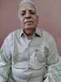
Shri Hisalal Nathu ji jat Khandwa.
External links
- Inscriptions in the Central Provinces and Berar by Rai Bahadur Hira Lal, Nagpur, 1932, p.74-86 (S.No. 96-159)
See also
References
- ↑ E. C. Sachau, Albemni’s India, p. 203.
- ↑ C. P. Administration Report, 1863-64, p. 9.
- ↑ Nimar District Gazetteer, 1908, p. 20.
- ↑ East Nimar District Gazeteer by P N Shrivastav, 1969, p.1
- ↑ Ibid, p.1
- ↑ East Nimar District Gazeteer by P N Shrivastav, 1969, p.2
- ↑ Hira Lal:Descriptive lists of inscriptions in the Central provinces and Berar, Nagpur, 1916, p.72 (S.No.101)
- ↑ Subodh Kapoor (2002). Encyclopaedia of Ancient Indian Geography, Volume 2. Genesis Publishing Pvt Ltd. p. 435. ISBN 9788177552997.
- ↑ B.H. Mehta (1984). Gonds of the Central Indian Highlands Vol II. Concept Publishing Company. p. 569.
- ↑ "Kalachuris of Mahismati". CoinIndia.
- ↑ Charles Eckford Luard, Ram Prasad Dube (1908). Indore State Gazetteer. Superintendent government printing, India, Original from University of Minnesota. p. 221.
- ↑ https://www.naidunia.com/madhya-pradesh/khandwa-maa-ashadevi-temple-in-harsood-2612710
- ↑ East Nimar District Gazeteer by P N Shrivastav, 1969, p.37
- ↑ East Nimar District Gazeteer by P N Shrivastav, 1969, p.48
- ↑ East Nimar District Gazeteer by P N Shrivastav, 1969, p.37
- ↑ East Nimar District Gazeteer by P N Shrivastav, 1969, p.37.
- ↑ East Nimar District Gazeteer by P N Shrivastav, 1969, p.37
- ↑ Indian Antiquary, Vol. XX, pp. 310-11; Journal, Asiatic Society of Bengal, Vol. XXVIII, pp. 1 to 8; Inscriptions in the C. P. and Berar, p. 77.
- ↑ https://www.hindujagruti.org/hindi/news/9369.html
- ↑ NHPC Limited: Indira Sagar Power Station
- ↑ Santoshi, Neeraj (4 August 2014). "Kishore Da's house lives in neglect in Khandwa". Hindustan Times.
- ↑ "Curfew drowns music riot on Kishore b'day". The Times of India. 3 August 2014.
- ↑ https://www.khandwa.nic.in/tourism.htm
- ↑ East Nimar District Gazeteer by P N Shrivastav, 1969, p.37
- ↑ Aitihasik Sthanavali by Vijayendra Kumar Mathur, p.115
- ↑ East Nimar District Gazeteer by P N Shrivastav, 1969, p.37
- ↑ "Alphabetical List of Monuments - Madhya Pradesh (Bhopal Circle)". Archaeological Survey of India, Government of India.
- ↑ List of Monuments of National Importance in Madhya Pradesh/West
- ↑ East Nimar District Gazeteer by P N Shrivastav, 1969, p.4
- ↑ 36.0 36.1 36.2 CV Vaidya, History of Medieval Hindu India
- ↑ Bhim Singh Dahiya:Jats the Ancient Rulers (A clan study)/The Jats, p. 56
- ↑ James Tod, Annals and Antiquities of Rajasthan, p.126
- ↑ Dr Naval Viyogi: Nagas – The Ancient Rulers of India, , p.171
- ↑ Kalhana: Rajatarangini
- ↑ Thakur Deshraj: Jat Itihas (Hindi), Maharaja Suraj Mal Smarak Shiksha Sansthan, Delhi, 1934, 2nd edition 1992 (Page 712)
- ↑ Fleet, John F. Corpus Inscriptionum Indicarum: Inscriptions of the Early Guptas. Vol. III. Calcutta: Government of India, Central Publications Branch, 1888, 254.
- ↑ Thakur Deshraj: Jat Itihas (Hindi), Maharaja Suraj Mal Smarak Shiksha Sansthan, Delhi, 1934, 2nd edition 1992 (Page 707)
- ↑ Dr Naval Viyogi: Nagas – The Ancient Rulers of India, p.148
- ↑ The Markandeya Purana, (Bibliotheca Indica), 1914, p. 333 and note; Fleet, Journal, Royal Asiatic Society, 1910, pp. 440-47; V. V. Mirashi, Corpus Inscriptionum Indicarum, Vol. IV, pt—I, p. XLIV; Indian Antiquary, 1876, p. 53.
- ↑ The Vedic Age, p. 278.
- ↑ Vol. II, Adhyaya 32, Verse 26, (Ed. by Rajendralal Mitra, Bibliotheca Indica), Calcutta, 1888.
- ↑ Adhyaya 43, Verse 29 (Anandashrama Ed.) Poona. 1907.
- ↑ The Sabha Parvan (Ed. by Edgerton, Poona, 1944, Sarga 28, Verses 1-38; Voi. VI, Udyoga Parvan (Ed. by S. K. De), Poona, 1940, Sarga 139, Verse 23.
- ↑ King Nila of Mahishmati fought with the Kauravas against the Pandavas in the great Bharata War.
- ↑ Arthashastra of Kautilya Tr. Shamsastry, 1929, p. 83,
- ↑ B. C- Law, Ujjaiyani in Ancient India, p. 4,
- ↑ H. C. Raychaudhuri, op. cit., p. 220.
- ↑ Jats the Ancient Rulers (A clan study)/Jat Clan in India,p. 276
- ↑ Journal of Bihar and Orissa Society, 1936, vol. XVII, p.65
- ↑ Rowlinson’s Herodotus, Vol. III, p. 160
- ↑ Bhim Singh Dahiya, Jats the Ancient Rulers ( A clan study), p. 276
- ↑ Source: Santosh Kumar Thakur (Khenwar) 9826546968