File:Bharatgarh Fort Aerial View.jpg
Jump to navigation
Jump to search

Size of this preview: 800 × 600 pixels. Other resolutions: 320 × 240 pixels | 1,080 × 810 pixels.
Original file (1,080 × 810 pixels, file size: 117 KB, MIME type: image/jpeg)
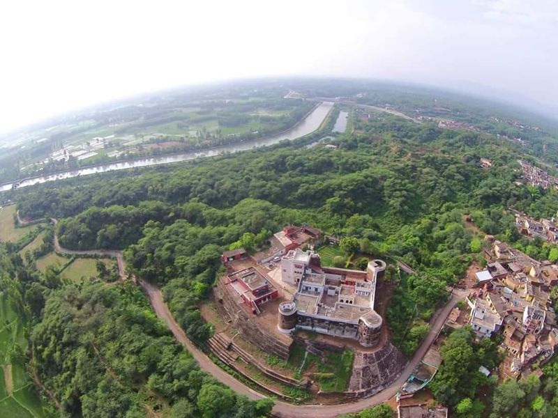
Aerial view of Bharatgarh Fort, It is visible from the Ropar Manali national highway. Built in 1783 and sitting atop a hill surrounded by the Shivalik hills, close to Satluj river, this structure spreading on a 20 Kanal residential area with about 100 acres of forest land surrounding it, has been the centre of activity and headquarters for Singhpuria misl in those times.
State:- Singhpuria
Dynasty:- Virk Jats
Credit:- Sardar Bhag Anmol Singh of Mangat, Rais Of Mangat.
Source - Jat Kshatriya Culture
File history
Click on a date/time to view the file as it appeared at that time.
| Date/Time | Thumbnail | Dimensions | User | Comment | |
|---|---|---|---|---|---|
| current | 10:13, 24 November 2020 | | 1,080 × 810 (117 KB) | Lrburdak (talk | contribs) |
You cannot overwrite this file.
File usage
The following page uses this file: