Kalimpong
| Author:Laxman Burdak, IFS (R) |

Kalimpong (कालिंपोंग) is a town and district in the Indian state of West Bengal. [1]
Location
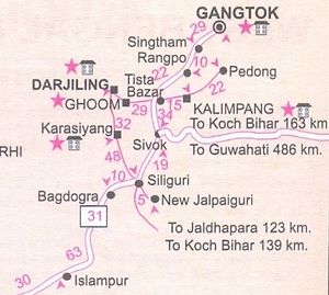
It is located on the banks of Teesta River at an average elevation of 1,250 metres (4,101 ft). Kalimpong district region comes under Gorkhaland Territorial Administration which is an autonomous governing body within the state of West Bengal.
Variants
Origin
The precise origin of the name Kalimpong remains unclear. There are many theories on the origin of the name.
- One widely accepted theory claims that the name "Kalimpong" means "Assembly (or Stockade) of the King's Ministers" in Tibetan, derived from Kalon ("King's ministers") and pong ("Assembly"). Formerly Kalimpong was known as 'Dalingkot' means isolated spot under Sikkimese rule.
- Or may be derived from the translation "ridge where we play" from Lepcha, as it was known to be the place for traditional tribal gatherings for summer sporting events. People from the hills call the area Kalempung ("the black spurs").[2]
- According to K.P. Tamsang, author of The Untold and Unknown Reality about the Lepchas, the term Kalimpong is deduced from the name Kalenpung, which in Lepcha means "Hillock of Assemblage";[3] in time, the name was distorted to Kalebung, and later further contorted to Kalimpong.
- Another possible derivation points to Kaulim (कलयुम), locally known as Odal (उदाल), Hindi: Udal, Oriya: Kodal, Scientific name Sterculia Villosa, a fibrous plant found in abundance in the region.[4] The plant is called hairy sterculia or elephant rope tree.
Jat clans
- Kalon - Panini mentions Kaunduparatha, as a part of Trigarta, Jullundur kingdom. The Kuluna, Mentioned by Panini, are the Kahlon Jats, Kuluta, Kālān, Krishna of the Puranas, Resident of Kullu, Himachal Pradesh. [5]
- Kale
History
The Indian Army's 27 Mountain Division is located on the outskirts of the city.[6]
Kalimpong is known for its educational institutions, many of which were established during the British colonial period.[7] It used to be a gateway in the trade between Tibet and India before China's annexation of Tibet and the Sino-Indian War. Kalimpong and neighbouring Darjeeling were major centres calling for a separate Gorkhaland state in the 1980s, and more recently in 2010.
The municipality sits on a ridge overlooking the Teesta River and is a tourist destination owing to its temperate climate, natural environment and proximity to popular tourist locations in the region. Horticulture is important to Kalimpong: It has a flower market notable for its wide array of orchids; nurseries, which export Himalayan grown flower bulbs, tubers and rhizomes, contribute to the economy of Kalimpong.[8]"General Information". Tourism Department. Darjeeling Gorkha Hill Council. The Tibetan Buddhist monastery Zang Dhok Palri Phodang holds a number of rare Tibetan Buddhist scriptures.[9]
The Kalimpong Science Centre, established under the Darjeeling Gorkha Hill Council (DGHC) in 2008 is a recent addition to its many tourist attractions. The Science Centre, which provides for scientific awareness among the students of the town and the locals sits atop the Deolo Hill.
कालिंपोंग
कालिंपोंग (Kalimpong): पश्चिम बंगाल के दार्जीलिंग जिले में तीस्ता नदी पर स्थित यह एक महत्वपूर्ण पर्यटन स्थल है. वर्तमान में यह शहर पश्चिम बंगाल का प्रमुख हिल स्टेशन है. यहां से कंचनजंघा श्रेणी तथा तिस्ता नदी की घाटी का बहुत सुंदर नजारा दिखता है. कलिंगपोंग 1700 ई. तक सिक्किम का एक भाग था. 18वीं शताब्दी के प्रारम्भ में भूटान के राजा ने इस पर कब्जा कर लिया था. आंग्ल-भूटान युद्ध के बाद 1865 ई. में इसे दार्जिलिंग में मिला दिया गया. 19 वीं शताब्दी के उत्तरार्द्ध में यहां स्काटिश मिशनरियों का आगमन हुआ. 1950 ई. तक यह शहर ऊन का प्रमुख व्यापार केंद्र था.कलिंगपोंग में अभी भी बहुत से औपनिवेशिक भवन हैं. इन भवनों में मुख्यत: बंगला तथा पुराने होटल शामिल हैं. ब्रिटिश ऊनी व्यापारियों द्वारा बनाए गए ये भवन मुख्य रूप से रिंगकिंगपोंग तथा हिल टॉप रोड पर स्थित हैं. इन भवनों में मोरगन हाउस, क्राकटी, गलिंका, साइदिंग तथा रिंगकिंग फॉर्म शामिल है. मोरगन हाउस तथा साइदिंग को सरकार ने अपने नियंत्रण में लेकर पर्यटक आवास के रूप में तब्दील कर दिया है. इन भवनों के नजदीक ही संत टेरेसा चर्च है. इस चर्च को स्थानीय कारीगरों ने प्रसिद्ध गोंपा मठ की अनुकृति पर बनाया है. कलिंगपोंग फूल उत्पादन का प्रमुख केंद्र है. यहां देश का 80 प्रतिशत ग्लैडीओली का उत्पादन होता है. इसके अलावा यह आर्किड, कैकटी, अमारिलिस, एंथूरियम तथा गुलाबों के फूल के लिए प्रसिद्ध है. गेबलेस तथा धालिस का भी यहां बहुतायत मात्रा में उत्पादन होता है. यहां प्रसिद्ध रेशम उत्पादन अनुसंधान केंद्र भी है. यह केंद्र दार्जिलिंग जाने के रास्ते पर स्थित है. 2008 में स्थापित कालिंपोंग विज्ञान केंद्र भी यहाँ का एक मुख्य आकर्षण है. भारतीय सेना के 27 माउंटेन डिवीजन का मुख्यालय इसी शहर में है. कालिंपोंग और दार्जिलिंग 1980 के दशक में और हाल ही 2010 में हुये गोरखालैंड आंदोलन के मुख्य केंद्र थे. गंगटोक से 75 किमी और बागडोगरा हवाईअड्डे से यह 80 किमी दूरी पर है.
External links
References
- ↑ "Carved out of Darjeeling, Kalimpong a district today". Times of India. 14.2.2017
- ↑ "Kalimpong Etymology". Government of West Bengal.
- ↑ "History of Kalimpong". Darjeelingnews.net. Darjeeling News Service.
- ↑ "Kalimpong". NITPU Kolkata, West Bengal.
- ↑ B S Dahiya: Jats the Ancient Rulers (A clan study)/Jat Clan in India,p. 252
- ↑ "India moves over 6,000 troops to border with China". The Hindu. Chennai, India. 13 December 2007.
- ↑ "Education and prospects for employment" (PDF). Government of Sikkim. p. 33
- ↑ "General Information". Tourism Department. Darjeeling Gorkha Hill Council.
- ↑ http://specials.rediff.com/getahead/2008/feb/08sld3.htm
