Yamunanagar

Yamunanagar (Hindi:यमुनानगर) is the district Hqs with a municipal corporation named as Yamunanagar-Jagadhri Corportation in Yamunanagar District in the Indian state of Haryana. Another important town is called Jagadhri. As these two towns, with the passage of time have intermingled, they are popularly referred to as the Twin cities of Yamuna Nagar-Jagadhri. The railway station servicing the town is called Jagadhri railway station. Other smaller towns are Jagadhari, Chhachhrauli, Radaur and Sadhaura. Total area of the district is 1,756 sq km and its population is 8,21,000.
Tahsils in Yamunanagar district
- Chhachhrauli
- Jagadhri
- Bilaspur
- Radaur
- Sadhaura (sub-tahsil)
- Saraswati Nagar (sub-tahsil)
- Pratap Nagar (sub-tahsil]]
History
Yamunanagar was created as a separate new district of Haryana on 16 October, 1989. Earlier to that it was a part of Ambala district. In the olden days, Yamuna Nagar was known as Abdullahpur. It used to be a small town (Kasba) with population concentrated, mainly around Jagadhri Railway Station. There was a century-old, flourishing timber market here. The river Yamuna forms its eastern boundary with the states of Uttar Pradesh and Uttaranchal. The district is bordered by Himachal Pradesh and the districts of Karnal, Kurukshetra and Ambala. There are 655 villages and 10 towns in this district.
Buddhism in India
Ref- Reviving Buddhist Heritage, Culture : Haryana Review, October 2011
Lord Buddha who propounded the doctrine of truth and non-violence, preached Buddhism in India and Asia, 2,600 years ago. And, these ruins of Buddhist culture, speak volumes about the glory and magnificence of the bygone Buddhist era. After witnessing the vast and elegant layout of the intricately-built-structures, Siddhartha Gauri marvelled at the true grandeur of the golden period when Buddhism was at its peak in India, promoting harmony and peace amongst different faiths. The site of that stupa made him very wistful and left him gasping for more information on such sites in India. While collecting information about such sites, he found too many of them across the country, mostly in Haryana. An idea occurred to him — to revive these degenerated structures to preserve and restore the Buddhist culture and Indian Heritage.
Buddhism in Haryana
.jpg)
Reference — Reviving Buddhist Heritage, Culture : Haryana Review, October 2011
According to Siddhartha Gauri the best findings about Buddhism are in Haryana. There were as many as 14 such Buddhist sites in Haryana. His research further revealed that Buddhism was in full influence in Haryana from King Ashoka’s era tifi the rule of king Harsh Vardhana who ruled over a vast area of North India in the 7th century Buddhism dominated the area and it flourished and prevailed in Haryana up to 14th century.
According to a report, Haryana was an important centre of Buddhism. The foundation of Buddhism inthe state was laid by Lord Buddha himself when he set his foot in Sugh village of Haryana, 5 km from Yamunanagar. Lord Buddha delivered his sermon here. Though the structural evidence is lost, but coins and figurines depict a picture of Sugh as a centre of learning as important as Taxila and Patliputra of that time. Both the Chinese traveler Huen Tsang and Sanskrit grammarian Panini also rated Sugh as one of the highly civilized and developed villages of that time. The highly evolved people of different faiths- the Buddhist, the Jains and the Hindus, were engaged in their intellectual activities and lived harmoniously at this place.
Siddharatha Gauri’s findings further reveal that nearly 300 forgotten Buddhist relics, including 53 in Madhya Pradesh, 14 in Haryana, 12 In Himachal Pradesh and one in Punjab, were also found. His best findings are In Haryana. There Is a Buddh Vihar at Adi Badri and Buddha stupas and monasteries at Chaneti, Topra and Sandhay villages - all in Yamunanagar district. Buddhists ruins have also been found at Amin in Kurukshetra, Assandh in Karnal district, at Agroha, Bhuna and Fatehabad villages in district Hisar, at Khokrakot in district Rohtak and at village Aherwan in district Palwal. The ancient sites of Amin in Kurukshetra and Khokrakot in district Rohtak have been listed on the official website of the Archaeological Survey of India, New Delhi. Asandh in Karnal has a remarkable history and is one of the tallest Stupas in North India which is 2,000 years old.
Places to visit
Dadupur, Kalesar Forest, Hathni Kund and Tajewala barrage. Another not to be missed place is the Ch Devi Lal Herbal Park, Chuharpur.
Yamunanagar town has many large industries in plywood, paper, sugar, metal and utensils sector. Saraswati Sugar Mills is located here. I S G E C and Railway Workshop are two other important industrial giants of the town.
Important Places
JAGADHRI: Known for utensils industry. Yugandhara & Ganadhari had been demolished by Nadirshah in 1739. The credit of rebuilding this city goes to Sardar Rai Singh in 1783. Gradually, it developed as a major centre of Metal Industry.
यमुनानगर
यमुनानगर भारत के हरियाणा राज्य के यमुनानगर ज़िले में स्थित एक नगर है। यमुनानगर हरियाणा राज्य का एक अति प्रसिद्ध जिला है जो हरियाणा के उत्तर पूर्व की ओर स्थित है। यमुनानगर, राज्य की राजधानी चंडीगढ़ के दक्षिण पूर्व में स्थित है। यह जिला शिवालिक पर्वतमाला की तलहटी में है। शहर से लगभग 30-40 किलोमीटर दूर शिवालिक पर्वत श्रेणियां आरंभ हो जाती हैं। उत्तरी सीमा चारों तरफ से पहाड़ों से घिरी हुई है, जहां जंगल और नदियां भी बहुतायत में हैं। यहां यमुना नदी पहाड़ों से मैदानी इलाके में बहती है। यमुनानगर हिमाचल प्रदेश में सिरमौर के साथ अपनी उत्तरी सीमा का साझा करता है। अंबाला, कुरुक्षेत्र और करनाल इसकी पश्चिम और दक्षिण सीमाओं से लगे हुए हैं। [1] यह जिला पर्यटन और प्राकृतिक सौंदर्य की दृष्टि से बेशुमार हैं। यमुनानगर जिले के कुछ महत्वपूर्ण ऐतिहासिक और धार्मिक स्थलों का विवरण नीचे दिया गया है।
आदि बद्री: यहाँ पर वैदिक कालीन मंदिरों के साक्ष्य हैं यहीं पर सरस्वती नदी का उद्गम स्थल है जो शहर से लगभग 40 किलोमीटर दूर है । इसी के पास ही आदि बद्री नामक स्थान है। जहां पर प्राचीन काल में भगवान ने तपस्या की थी। शिवालिक पर्वतमाला की ऊंची चोटी पर लगभग 2000 फीट की ऊंचाई पर माता मंत्रा देवी का मंदिर बना हुआ है। यहीं पर आदि केदार मंदिर हैं।
चनेती: चनेती गांव में बौद्ध स्तूप बना हुआ है। चनेती बौद्ध स्तूप जगाधरी से 3 किमी दूर स्थित है। गांव के करीब 100 वर्ग मीटर के क्षेत्र में ईंटों से बने से 8 मीटर की ऊँचाई वाला एक विशाल मकबरा है। गोल आकार में बना, यह एक पुराना बौद्ध स्तूप है। हेन त्सांग के अनुसार, यह राजा अशोक द्वारा बनाया गया था। मौर्य राजा अशोक के शासनकाल के दौरान, प्राचीन शहर श्रुघ्ना (आधुनिक सुघ) बौद्ध धर्म का एक महत्वपूर्ण केंद्र बन गया। जैसा कि चीनी तीर्थयात्री युआन चुंग के यात्रा के बारे में बताया गया है कि यह जगह दसवें स्तूप और एक मठ से सुशोभित हुई थी।
खिजराबाद (AS, p.257) नामक स्थान के पास ही तोपरा स्थित है जहां पहले वह अशोक स्तंभ था जिसे फिरोजशाह तुगलक दिल्ली से ले गया था। इस कस्बे के पास ही पहाड़ की चोटी पर लाला वाले पीर की छोटी सी मजार है जहां पर मेला लगता है।
बिलासपुर: यहां का सबसे बड़ा तीर्थ बिलासपुर के समीप कपाल मोचन है जहां पर गुरु पूर्णिमा के दिन भारी संख्या में श्रद्धालु आते हैं। बिलासपुर का ऐतिहासिक महत्व है, क्योंकि यह महाभारत के लेखक, वेद व्यास के नाम पर है। कपालमोचन, ऋणमोचन और सूर्य कुंड तालाब बिलासपुर में पवित्र माने जाते हैं। विलासपुर में जाट-राज्य था। रानी दयाकुंवरि के नि:सन्तान मरने के कारण इस राज्य को सरकार ने अपने अधिकार में कर लिया। यह घटना सन् 1819 ई० की है। कलसिया के महाराज शोभासिंह जी ने अपने अधिकार का दावा पेश किया, किन्तु सन् 1820 में उनका दावा खारिज हो गया। (ठाकुर देशराज,पृ.513) इसके साथ ही बिलासपुर के पास पंचमुखी हनुमान जी का मंदिर है जहां मंगलवार और शनिवार को दूर-दूर से लोग आते हैं।
हरनौल नामक गाँव के पास पंचतीर्थी धाम नामक प्राचीन तीर्थ है। कहते हैं कि यहाँ पर पांडव आए थे और पाँचों पांडवों की मूर्तियाँ यहाँ स्थापित हैं।
जगाधरी: यमुनानगर के उत्तर में अतिप्राचीन शहर जगाधरी है। पाणिनि ने अष्टाध्यायी (4.2.130) में युगंधर नामक एक देश का उल्लेख किया है जिसकी पहचान जगाधरी से की गई है। युगंधर का उल्लेख महाभारत (IV.1.9) में धन-धान्य से परिपूर्ण देश के रूप में किया गया है- 'सन्ति रम्या जनपथा बह्व अन्नाः परितः कुरून, पाञ्चालाश चेथिमत्स्याश च शूरसेनाः पटच्चराः, दशार्णा नव राष्ट्रं च मल्लाः शाल्व युगंधराः' (IV.1.9). युगंधर नामक एक प्राचीन स्थान का उल्लेख महाभारत, वनपर्व में हुआ है- 'युगंधरे दधिप्राश्य उषित्वा चाच्युतस्थले तद्वद् भूतलये स्नात्वा सपुत्रावस्तुमर्हसि।' महाभारत, वनपर्व (3-131-9).
जगाधरी इलाका सन् 1832 ई० में रानी दयाकुंवरि के मरने पर सरकार ने जब्त कर लिया था। यह रानी सरदार भगवानसिंह की धर्मपत्नी थी। यह रियासत सब तरह से धन-धान्य से पूर्ण थी। (ठाकुर देशराज, पृष्ठ-513)
इस जिले में कालेश्वर महादेव, सतकुम्भा तीर्थ आदि स्थल है। सरस्वती नगर मुस्तफाबाद एक पुराना कस्बा है। जहां पर सरस्वती धाम है । यमुनानगर शहर में ही चिट्टा मंदिर, गुरुद्वारा थडा साहिब, संतपुरा गुरुद्वारा ,जंगला वाली माता जी का मंदिर प्रसिद्ध है। इस जिले में प्राचीन लौहगढ़ साहिब गुरुद्वारा भी स्थित है। इस जिले मे यमुना, पथराला, बोली नदी और सोम्ब नदी बहती हैं।
यह शहर प्लाईवुड इकाइयों के क्लस्टर के लिए जाना जाता है। यह बड़े उद्योगों को देश की बेहतरीन लकड़ी उपलब्ध कराने के लिए जाना जाता है। लक्कड़ की मर्केट बहुत बड़ी है। यहाँ पर पेपर और चीनी मिल हैं। यहाँ पर बहुत बड़ा और प्रशिद्ध बर्तन-बजार है। सरस्वती नदी का उद्गम स्थल आदिबद्री,काठगढ़ व सिखों की पहली राजधानी, लोहगढ़ (बन्दा बहादुर सिंह गुरुद्वारा) भी यमुनानगर में ही है।
यमुनानगर शिवालिक पहाड़ियों की सुंदर तलहटी में स्थित है। यमुना नदी की प्राचीन सुंदरता के साथ पहाड़ियों का मिलन मंत्रमुग्ध कर देने वाला है। ग्रे पेलिकन नाम का एक गेस्ट हाउस नदी के किनारे पर है। इसकी देख भाल राज्य सरकार करती है कालेसर वन्यजीव अभयारण्य यमुना नगर के पूर्वी भाग में स्थित है। वन्य जीवों के अलावा, खैर, शीशम, तुन, सेन और आंवला जैसे पेड़ भी यहां पाए जाते हैं। चौधरी देवी लाल हर्बल नेचर पार्क में औषधीय पौधों की अधिक पैदावार है। [2]
यमुनानगर की सीमा के पास ही माता बाला सुंदरी जी का पावन धाम है जो हिमाचल के त्रिलोकपुर गांव में है ।इस जिले की सीमा से लगभग 30-35 किलोमीटर दूर सिद्धपीठ शाकम्भरी देवी का मंदिर है जो सहारनपुर में पड़ता है। पौंटा साहिब भी यहां से कुछ ही दूरी पर स्थित है।
Prominent persons
- Chaudhary Dilbag Singh Sandhu - Member Legislative Assembly, Haryana.
- Dr. Raj Pal Singh - Associate Professor Department of History, M L N College, Yamunanagar.
- Dr. Rajender Sandhu - Sandhu Clinic, near ITI, Yamunanagar.
- Dr. Surendra Sandhu - Haryana Govt. service.
- Jai Paul Singh Dahiya - Retired IAS officer.
- Justice Pritam Pal-Lokayukta Haryana and Retd. High Court Judge
- Prophet Bajinder Singh - A Christian Missionary famous in Punjab
Gallery
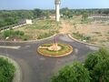
Chaudhari Devilal Herbal Nature Park Yamunanagar
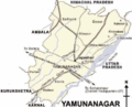
Yamunanagar Map


External Links
- Ch. Devi Lal Institute of ManagementStudies, Buria Road, Bhagwangarh, District Yamunanagar
- Buddhist Heritage unearthed at Jat inhabitant areas in Indian sub-continent - Jatland Forums
- Yamunanagar on Flickr