Aksaray
| Author:Laxman Burdak, IFS (R) |

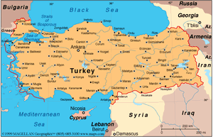
Aksaray is a city in the Central Anatolia region of Turkey and the capital of Aksaray Province. It is mentioned by Pliny as Archelais. [1]
Variants
- Archelais Garsaura
- Archelais (Pliny.vi.3)
- Archelaïs (Greek: Ἀρχελαΐς)
- Colonia (Κολώνεια) (in Roman times)
- Garsaura
- Nenessa (Nenossos) (in ancient Hittite texts)
- Taksara
- Aksaray pronounced [ˈaksaɾaj] (Hindi:अक्साराय)
- Ancient Greek: Γαρσάουρα Garsaura
- Koine Greek: Ἀρχελαΐς Arhelays
- Medieval Greek: Κολώνεια Koloneya
Jat clans
- Archi = Archelais (Pliny.vi.3)
- Gadasia = Garsaura = Archelais (Pliny.vi.3)
- Nen = Nenessa = Archelais (Pliny.vi.3)
- Nenwa = Nenossos = Archelais (Pliny.vi.3)
- Takas = Taksara = Archelais (Pliny.vi.3)
Etymology
In antiquity the area was named Archelais Garsaura, which was mutated to Taksara during the Seljuk Turkish era, and then to Aksaray. Aksaray means "White Palace" in Turkish.
History
The city of Aksaray has a long history and was an important stopover point on the Silk Road that transited Anatolia for centuries.
First mentioned as Nenessa (Nenossos) in ancient Hittite texts, The town of Garsaura was named Archelaïs (Greek: Ἀρχελαΐς) by Archelaus of Cappadocia, the last Cappadocian king.
In Roman times, the town was known as Colonia (Κολώνεια) and was a bishopric and an important military centre, holding an imperial aplekton. Of its bishops, Euphrasius was at the First Council of Nicaea in 325; Bosporus (who is mentioned in the correspondence of Basil the Great and Gregory of Nazianzus) at the First Council of Constantinople in 381; Daniel at the Council of Ephesus in 431; Aristomachus (who was also a signatory of the letter of the bishops of the Roman province of Cappadocia Tertia, to which Colonia belonged, to Byzantine Emperor Leo I the Thracian about the killing of Proterius of Alexandria in 458) at the Council of Chalcedon in 451; Alexander at a council in Constantinople called by Patriarch Menas of Constantinople in 536; and Conon at the Trullan Council of 692.[2] No longer a residential bishopric, Colonia in Cappadocia is today listed by the Catholic Church as a titular see.[3] Colonia is also a titular Turkish metropolis of the Ecumenical Patriarchate of Constantinople.
During Ottoman times, the town was prosperous in part because of its proximity to Tuz Gölü (Lake Tuz), which was a primary source of salt for Anatolia.[4]
The region came under the control of the Seljuk Turks after the Battle of Manzikert in 1071. The Anatolian Seljuk Sultanate they founded left important landmarks in and around Aksaray. The Moroccan traveller Ibn Battuta, who visited the region in the 14th century, was impressed by the class of Muslim traders that had emerged in Aksaray and noted the urban centre as "a beautiful city, surrounded by waterways and gardens, with a water supply coming right to the houses of the city."
In 1470 Aksaray was incorporated into the Ottoman Empire by İshak Pasha after a protracted struggle against the Karamanids. Many inhabitants of the city were relocated to Constantinople (recently captured by the Ottomans) where they were settled in a part of the city that also came to be named Aksaray.
Tourism
It is a pleasant small city with the Melendiz river running through it and several monuments dating back to the pre-Ottoman era as well as some impressive examples of government buildings from the early Turkish Republic that are gathered around the main square. The nearest airport is Kapadokya Nevşehir Airport (NAV) which is 62.1 km away from the city.
Mention by Pliny
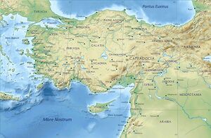
Pliny[5] mentions...Cappadocia1 has in the interior Archelais,2 a colony founded by Claudius Cæsar, and past which the river Halys flows; also the towns of Comana,3 watered by the Sarus, Neocæsarea,4 by the Lycus,5 and Amasia,6 in the region of Gazacene, washed by the Iris. In Colopene it has Sebastia and Sebastopolis;7 these are insignificant places, but still equal in importance to those just mentioned.
1 The boundaries of Cappadocia varied under the dominion of the Persians, after the Macedonian conquest, and as a Roman province under the emperors.
2 Founded by Archelaüs, the last king of Cappadocia. In Hamilton's Researches, the site has been assumed to be the modern Ak-serai, but that place is not on the river Halys, as Leake supposes. It is, however, considered that Ak-serai agrees very well with the position of Archelais as laid down in the Itineraries, and that Pliny may have been misled in supposing that the stream on which it stood was the Halys.
3 Also called by the name of Chryse, or "Golden," to distinguish it from another place of the same name in Pontus. It is generally supposed that the town of Al-Bostan, on the Sihoon or Sarus, is on or near the site of this Comana.
4 Now called Niksar, according to D'Anville, though Hardouin says that it is Tocat. Parisot remarks, that this place belonged rather to Pontus than to Cappadocia.
5 A small tributary of the Iris, or Yeshil-Irmak, mentioned in the next Chapter.
6 Both to the west of Neo-Cæsarea. According to Tavernier, as quoted by Hardouin, the modern name of Sebastia is Sivas.
7 Still called Amasia, or Amasiyeh, and situate on the river Iris, or Yeshil Ermak. It was at one time the residence of the princes of Pontus, and the birth-place of the geographer Strabo. The remains of antiquity here are very considerable, and extremely interesting.
References
- ↑ Natural History by Pliny Book VI/Chapter 3
- ↑ Michel Lequien, Oriens christianus in quatuor Patriarchatus digestus, Paris 1740, Vol. I, coll. 413-416; Raymond Janin, v. 2. Colonia, in Dictionnaire d'Histoire et de Géographie ecclésiastiques, vol. XIII, Paris 1956, col. 326; Pius Bonifacius Gams, Series episcoporum Ecclesiae Catholicae, Leipzig 1931, p. 440
- ↑ Annuario Pontificio 2013 (Libreria Editrice Vaticana 2013 ISBN 978-88-209-9070-1), p. 873
- ↑ Swan, Suzanne (2012) [1st pub. 2003], Eyewitness Travel Turkey, London, UK: Dorling Kindersley Ltd., ISBN 978-1-40536-888-9
- ↑ Natural History by Pliny Book VI/Chapter 3
Back to Jat Places in Turkey
