Hisar

Hisar (हिसार) is a city and district in Haryana, India. It is a big city in Haryana, well known for Chaudhary Charan Singh Haryana Agricultural University.
Variants of name
- Aishukari (ऐषुकारि) (Panini)
- Eshukaribhakta (एषुकारिभक्त) (Panini) = Hisar (हिसार) (AS (p.114)
- Hisar (Hindi: हिसार),(Punjabi: ਹਿਸਾਰ),
- Hissar
Founder
Hisar was founded as Hissar-e-Firoza by Firoz Shah Tughlaq [1], on the demolished ruins of an existing prosperous Hindu and Jain city of Iksaru. Firoz Shah Tughlaq was son of Gayas-ud-din's younger brother Rajab by his Bhatti wife, who was the daughter of Rana Mall, the chief of Abohar.
Origin
Hisar gets its name from Jats who came from Afghanistan from place known as Bal Hisar or Mood Hisar or Hisar, a town in Afghanistan. Hisar is an abundant city in Afghanistan. Bal Hisar city was founded by Balhara gotra jats and Mood Hisar city by Moond gotra jats in Afganistan. [2]
Tahsils in Hisar district
Villages in Hisar Tahsil
Agroha, Alipur, Arya Nagar, Badhawar, Badon Brahmanan, Badon Pati Awal, Badon Pati Doyan, Badon Rangran, Bahbalpur, Balak, Balawas, Balsmand, Banbhori, Bandaheri, Barwala (MC), Bayana Khera, Bhada Khera, Bhagana, Bhaini Badshahpur, Bhairi Akbarpur, Bharri, Bherian, Bhiwani Ruhelan, Bhojraj, Bichpari, Bir Hisar, Bithmara, Bobua, Budha Khera, Bugana, Burak, Bure, Chamar Khera, Chandnaud, Chaudhriwas, Chhan, Chikanwas, Chiraud, Dabra, Daha, Dahima, Daulatpur, Deva, Dhadh, Dhani Jatan, Dhansu, Dhingtana, Dhiran Was, Dobeta, Dobhi, Durjanpur, Fransi, Gaibipur, Gangwa, Gawar Hisar, Gianpura, Gorchhi, Guzar, Hari Kot, Harita, Hasangarh, Hindwan, Hisar(M Cl), Isharheri, Jagan, Jeora, Juglan, Kaimri, Kallar Bhaini, Kaluwas, Kanoh, Kharak, Kharar, Kharia Hisar, Kharkhara, Kharkhari Hisar, Khedar, Kheri Barki, Khokha, Kirara, Kirmara, Kirori, Kirtan, Kuleri, Kumbha Khera, Ladwa, Landhari Sukh Lambran, Latani, Ludas, Madloda, Mangali Akalan, Mangali Brahmnan, Mangali Jhara, Mangali Mohbat, Mangali Surtia, Mater Sham, Mayyer, Meengni Khera, Mirka, Mirpur, Mirzapur, Muklan, Nalwa, Nang Thala, Nathwana, Nawagaon, Nayana, Neoli Kalan, Pabra, Panghal, Panhari, Panihar Chak,(17) Parbhuwala, Patan, Payal, Raipur, Rajli, Rawalwas Kalan, Rawalwas Khurd, Rawat Khera, Risalu Khera, Sabarwas, Saharwa, Sahu, Salemgarh, Samani, Sandlana, Sandol, Sarera, Sarsana, Sarsana, Sarsod, Satrod Kalan, Satrod Khas, Satrod Khurd, Shahpur, Shamsukh, Singhran, Siswala, Sotha, Sulkhani, Sundawas, Surewala, Talwandi Badshahpur, Talwandi Rana, Talwandi Rukka, Thaska, Tokas, Uklana, Uklanamandi (MC),
Demographics
As of 2001 India census, Hisar had a population of 256,810. Males constitute 55% of the population and females 45%. Hisar has an average literacy rate of 71%, higher than the national average of 59.5%: male literacy is 76%, and female literacy is 64%. In Hisar, 13% of the population is under 6 years of age. There is a large number of Sikhs also in Hisar due to its proximity to Punjab.
Mention by Panini
V. S. Agrawala[3] mentions Vishayas known to Panini which includes - Aishukari (ऐषुकारि), under Aishukari Gana (ऐषुकारि गण) (IV.2.54).
History
V. S. Agrawala[4] writes that Ashtadhyayi of Panini mentions janapada Kuru (कुरु) (IV.1.172) - It was known to Panini as a janapada and a Kingdom. Hastinapura (VI.2.101) was its capital. The region between triangle of Thanesar, Hisar and Hastinapur was known by three different names. Kururashtra proper between Ganga River and Yamuna with its capital Hastinapur; Kurujangala equal to Rohtak, Hansi, Hisar; and Kurukshetra to the north with its centres at Thaneswar, Kaithal, Karnal.
Since the Aryan migration through current times Hisar is dominated by the Jats race. Jats, like the citizens of ancient Roman alternated between farming and fighting for their lands in this part of the world for centuries. This fierce race had been the buffer by default shielding Hindus from foreign Islamic invasions from the west. Jats have cultivated and protected the lands in and between 'Punjab region' and 'doab' (two rivers Yamuna and Ganga - this region today includes New Delhi, Haryana, Punjab, Rajasthan, Gujarat, Himachal Pradesh, Uttar Pradesh, Uttaranchal, Pakistani Punjab, Pakistani Sindh). Research conducted during the British rule identified Jats as an integral and vital part of the history of India. In the Punjab region and present day Haryana, Jats had long cultivated the lands and ardently protected the inhabitants ('Chattis Kaum' - thirty six communities) against the Islamic invasions from time to time. The city of Hisar was no different, although founded by a Muslim ruler, Firozshah Tughlaq in 1354 A.D the city was predominantly Hindu. The word ‘Hisar’ is an Arabic word, which means ‘Fort’. The city, which we know today as ‘Hisar’, was originally called ‘Hisar Firoza (also Hisar-e-Firoza) or in other words the ‘Fort of Firoz’. But as the days rolled by, the very word ‘Firoza’ was dropped from its original name.
It was in these lands that the very first evidence of the presence of man was discovered with the excavation of Agroha, Banawali and Kunal. All of these were the pre-Harappan settlements, bringing for us the very first images of prehistoric times. The presence of the pillar in the Hisar fort belonging to the time of Emperor Ashoka (234 BC) was originally from Agroha. The discovery of coins of the Kushan Kings tells tales of ancient India.
The construction work of the city of Hisar was started in the year 1354 A.D. under the personal supervision of Firozshah himself who stayed here for a sufficient time. The boundary wall of Hisar Firoza was built up of stones brought from the hills of Narsai. The fort city was also surrounded by a big ditch dug round the wall. A large and deep tank was constructed inside the fort, and the water used to replenish the ditch. Inside the fort a fine palace, having a complex of different buildings was built. Well laid out gardens added to the beauty of the palace. The initial stage of the city, it was reported, was completed after the incessant work of two and a half years.
The nobles and Amirs were also directed by the Sultan to get the residences built here. The buildings were constructed with lime and burnt bricks. The fort-city had four gates which were subsequently named as the Delhi Gate and Mori Gate to the east, the Nagori Gate to the south and Talaqi Gate to the west. These gates were completely razed in mid-eighties by then chief minister Bansi Lal to widen and modernize the roads.
While constructing the palace, popularly known as ‘Gujari Mahal’ for his beloved, Firozshah also built a new city around it. The Gujari Mahal still stands in its austere majesty. This palace is a complex of different buildings, including the royal residence of the sultan Firozshah, Shahi Darwaza, Diwan-e-Aam, Baradari with three tehkhanas, a hamam, a mosque and a pillar. The style of architecture of the Gujari Mahal is dignified. The palace has beautifully carved stone pillars.
Most of the material used for the constructing the Gujari Mahal complex including the nearby mosque was from Hindu or Jain temples desecrated and destroyed by Firozshah's army. The elaborate fingurines of dancers with musical instruments carved in stone can still be seen laid in the pillars and walls of the mosque.
In 1408 Hisar felt into the hands of the rebels, but was recovered by the royal army under the Emperor Mahmud Tughlaq in person. In 1411 the tract of Hansi came into the hands of Khizar Khan, and he ascended to the throne of Delhi in 1414 as the first Sultan of the Sayyad Dynasty. In 1420 the fief of Hisar was conferred on Mahmud Hassan as reward for good services. During the feeble dynasty of the Lodhis (1451-1526) Hisar continued to form a part of Haryana, and was granted as a fief to Muhabbat Khan in the reign of Bahlol Lodi (1451-89)
When Babur invaded India in 1524-26, Hisar was an important strategic center of Ibrahim Lodi’s empire. Before the battle of Panipat in 1526, on reaching the Ghaggar, Babur learnt that the troops from Hisar, led by Hamid Khan, were advancing towards him. He then dispatched prince Humayun with an army sufficient to succeed in defeating the enemy. Babur handed over the city of Hisar to Humayun as a reward for his success in his first military expedition. Humayun ruled over India twice first from 1530 to 1540 and again from 1555 to 1556. During his first reign a mosque known as Jama Masjid was built here by Amir Muhammad in 1535.
When Mohd. Gouri Won in the second battle of Terrain against Prithvi Raj Chauhan, he went back to his country Afghanistan via Hisar. At that time Hisar was one of the most important places to take rest for some time.
During Akbar’s reign (1556-1605) Hisar became once more a place of considerable importance. It was made the headquarters of the revenue division known as a sirkar. As some of the Mughal Princes who were attached to Hisar, subsequently became the Emperors, the city of Hisar was then known in the history of India as the Duke of Wellington of the Mughal Era.
The last noteworthy actor in the history of the tract of Hisar before the advent of the British power was George Thomas (1756-1802). He was an independent mercenary who became ruler of a large tract of Haryana, including Hisar and Hansi, for a few years from 1797 to 1802.He got the area on a platter given that by that time it stood ravaged variously by sikh misls who in turn had got into conflict with each other of quite serious nature as also the political vacuum having arisen due to internecine disagreements within the Jat and Maratha rulers as also the intra household conflicts of the said kingdoms. The Jahaz Pul and the Jahaz Kothi situated to the east of the city of Hisar, still remind us of this 'Irish Soldier Of Fortune'. Thomas used the Jahaz Kothi, which was once a temple and afterwards converted into a mosque, as a residence. He was disposed of by the Britishers shortly afterwards. The area was subsequently offered to the king of Jind (a Jat sikh of sidhu clan) who declined to accept it on grounds of it not being feasibly maintainable revenue wise.
Hisar gained importance in early sixties when the Agriculture University was set up as an extension centre of the Punjab Agricultural University, Ludhiana. Ever since, the government's positive policies have played a vital role in the economic development of the city. The industrial and agricultural policy of the government has attracted large number of farmers and entrepreneurs and has resulted into the industrialization in and around the city.
Ram Sarup Joon[5] writes that The Johiya Raja, Sher Singh Johiya, whose capital was Rang Mahal, near Surat Garh, gave a tough resistance to the Rathores. He never admitted the suzerainty of the Rathores even though he had perforce to leave the Punia territory in Bikaner and retreat towards Hissar.
Archaeological Findings
इतिहासकार स्वामी ओमानन्द सरस्वती लिखते हैं
- यौधेयों की पांचवें प्रकार की मुद्रायें जो कि यौधेय गण की अन्तिम मुद्रायें मानी जाती हैं, और प्रायः जिसे गण राज्यों अथवा उनकी मुद्राओं का स्वल्प ज्ञान रखने वाले व्यक्ति भी जानते हैं, उन पर ब्राह्मी लिपि तथा संस्कृत भाषा में "यौधेय गणस्य जय" लिखा है । मध्य में कार्त्तिकेय अपनी शक्ति लिये खड़ा है । उसके एक पग के पास मयूर (मोर) का चित्र चित्रित है । इस मुद्रा पर कार्त्तिकेय की शक्ति (भाला) और उसके शिर के बीच ब्राह्मी में "द्वि" लिखा है । इस मुद्रा पर दूसरी ओर चलती हुई देवी का चित्र है । देवी का बायां हाथ कटि पर स्थित है तथा दायां हाथ ऊपर उठा रखा है । हाथ में कंगन भी प्रतीत होते हैं । देवी के दायें हाथ के नीचे पुष्पों से परिपूरित पात्र (कलसा) भी विद्यमान है । देवी के बायें ओर इस प्रकार का चिह्न है । देखिये, द्वितीय फलक पर ५ संख्या (नम्बर) वाली मुद्रा । वर्तुलाकार इस में मुद्रा पर देवी के चारों ओर बनी मणियों की माला यह द्योतित करती है कि यह अमूल्य रत्नों तथा धन-धान्य से परिपूरित बहुधान्यक अर्थात् हरयाणा की मुद्रा है । यह यौधेयों की विजय की सूचना देने वाली मुद्रा है । सभी इतिहासज्ञों का यह विचार है कि कुषाणों को पराजित कर उखाड़ फेंक देने के पश्चात् यौधेय गण ने अपनी इस मुद्रा को ढाला (बनाया) था । यह मुद्रा प्रायः सम्पूर्ण हरयाणे में मिलती है । मेरठ, हापुड़, सुनेत, करौंथा, अटायल, आंवली, मोहनबाड़ी, हाँसी, हिसार, भिवानी, नौरंगाबाद, दादरी, मल्हाणा, सीदीपुर लोवा आदि स्थानों से यह मुद्रा हमें प्राप्त हुई है । महम, सोनीपत, जयजयवन्ती, सहारनपुर आदि अनेक स्थानों पर भी यह लोगों को पर्याप्त संख्या में मिली है ।[6]
हिसार (हरयाणा)
हिसार (हरयाणा) (AS, p.1026): विजयेन्द्र कुमार माथुर [7] ने लेख किया है .... इस नगर को फ़िरोज़ शाह तुग़लक़ (राज्यभिषेक 1351 ई.) ने बसाया था। कहा जाता है कि हिसार के पास के वनों में फ़िरोज़ आखेट के लिए रोजाना जाया करता था और उसने यहां एक दुर्ग (हिसार दुर्ग) बनवाया था, जहां कालांतर में आबादी हो गई। हिसार के पास अग्राहा नामक स्थान है, जो प्राचीन अग्रोदक कहा जाता है। यह नगर महाभारत कालीन माना जाता है। अलक्षेंद्र के आक्रमण के समय (327 ई. पू.) इस स्थान पर आग्रेयगण का राज्य था। वासुदेव शरण अग्रवाल का विचार है कि पाणिनि 4, 2, 54 में उल्लिखित एषुकारिभक्त हिसार का ही प्राचीन नाम है। इसे कुरू प्रदेश का एक बड़ा नगर कहा गया है।
हिसार परिचय
हिसार एक शहर, जो पश्चिमोत्तर हरियाणा राज्य, पश्चिमोत्तर भारत में पश्चिमी यमुना नहर की हांसी शाखा पर स्थित है। इसकी स्थापना तुग़लक़ शासक फ़िरोज़ शाह तुग़लक़ ने की थी। प्राचीन समय में यहाँ कई आदिवासी जातियाँ रहा करती थीं। हिसार हरियाणा राज्य के पर्यटन के लिए एक आकर्षक स्थल है। पर्यटक यहाँ पर कई ख़ूबसूरत स्थलों की सैर कर सकते हैं। यहाँ कपास, अनाज और तेल के बीजों का बड़ा बाज़ार है। इस बाज़ार के लिए यह बहुत प्रसिद्ध है।
18वीं शताब्दी में जनशून्य किए गए इस शहर पर बाद में ब्रिटिश अभियानकर्ता जॉर्ज थॉमस ने क़ब्ज़ा कर लिया। 1867 में हिसार की नगरपालिका का अध्ययन किया गया। यह शहर एक दीवार से घिरा है, जिसमें चार दरवाज़े हैं- 'नागोरी गेट', 'मोरी गेट', 'दिल्ली गेट' तथा 'तलाकी गेट' के नाम से प्रसिद्ध है। यहाँ फ़िरोज़ शाह के क़िले व महल के अवशेषों के साथ-साथ कई प्राचीन मस्जिदें हैं, जिनमें जहाज़ भी एक है, जो अब एक जैन मंदिर है। प्राचीन समय में यह हड़प्पा सभ्यता का मुख्य केन्द्र था। प्राचीन समय में यहाँ कई आदिवासी जातियाँ रहती थी। इन जातियों में भरत, पुरू, मुजावत्स और महावृष प्रमुख थी।
कृषि और खनिज: गेहूँ व कपास यहाँ की प्रमुख फ़सलें हैं। अन्य फ़सलों में चना, बाजरा, चावल, सरसों व गन्ना शामिल हैं।
उद्योग और व्यापार: उद्योगों में कपास की ओटाई, हथकरघा बुनाई और कृषि यंत्रों व सिलाई मशीनों के निर्माण से जुड़े उद्योग शामिल हैं। यहाँ पर कपास, अनाज और तेल के बीजों का बड़ा बाज़ार है। इस बाज़ार के लिए यह बहुत प्रसिद्ध है।
शिक्षण संस्थान: इस शहर में चौधरी चरण सिंह हरियाणा कृषि विश्वविद्यालय, गुरु जंभेश्वर विश्वविद्यालय, चौधरी चरण सिंह प्रबंधन महाविद्यालय, कृषि इंजीनियरिंग व प्रौद्योगिकी महाविद्यालय और हिसार गवर्नमेंट कॉलेज व डी.एन. कॉलेज सहित कई महाविद्यालय शामिल हैं।
पर्यटन: हरियाणा में स्थित हिसार एक ख़ूबसूरत स्थान है और हिसार पर्यटन का आकर्षक स्थल है। पर्यटक यहाँ पर कई ख़ूबसूरत स्थलों की सैर कर सकते हैं। यहाँ पर सम्राट अशोक के काल का एक स्तम्भ, कुषाण वंश के सिक्के व अन्य अवशेष भी मिले हैं। कुल मिलाकर हिसार बहुत ख़ूबसूरत है और पर्यटक यहाँ पर अनेक ख़ूबसूरत स्थान देख सकते हैं। पर्यटक स्थलों की सैर के बाद यहाँ पर अनेक ऐतिहासिक इमारतों की यात्रा की जा सकती है।
संदर्भ: भारतकोश-हिसार
एषुकारिभक्त
विजयेन्द्र कुमार माथुर[8] ने लेख किया है ...एषुकारिभक्त (AS (p.114) - पाणिनि अध्याय 4.2.54 में उल्लेख है. यह शायद वर्तमान हिसार (हरयाणा) है.
Jat Gotras in Hisar
See - List of Jat Gotras in Hisar district
Notable Jats from Hisar district
- Chandagi Ram
- Chaudhary Mani Ram Sehrawat
- Jagat Jakhar
- J.S. Lamba
- Mallika Sehrawat
- Master Narain Singh Kataria
- Prof G. R. Godara
- Ram Chander Bainda
- Saina Nehwal
- Virender Choudhary
- Ch Udaiveer Kundu - From village Nahla, Elected as Parshad of Ward No.13 Hisar.[9]
- Ch Karmveer Dhillo - Elected as Parshad of Ward No.18 Hisar.[10]
- Smt Chandrapati Dhanda - From Azadnagar, Elected as Parshad of Ward No.16 Hisar.[11]
- Kiran Godara - Selected for Olympic Qualifier team of wrestling [12]
- Ram Nath Bamal (राम बाम्बल S/O Late श्री ॐ प्रकाश बाम्बल): Alumni of BITS Pilani, PURDUE University (USA), IIT Palakkad, IIM Rohtak (MBA) & IIM Calcutta (SENIOR MANAGEMENT PROGRAMME). Professional Profile: "https://www.linkedin.com/in/inetworks/".
Administrative set-up of District Hisar
Hisar continued to be the District Headquarters of the largest district in the state till its reorganization; some parts of it were transferred to Jind in 1966 when Jind was made a new district. Tehsil Bhiwani and Loharu estate were transferred to the Bhiwani District when Bhiwani was carved out in 1974. It was further bifurcated when the Sirsa District become a new district, made entirely out of Hisar District. Now Fatehabad Districthas also been carved out of this district.
At present Hisar district consists of four tehsils and three sub-tehsils. The tehsils are Hisar, Hansi, Narnaund and Adampur and the sub-tehsils are Barwala, Uklana and Baas.
Hisar is a divisional headquarters of the Divisional Commissioner and also the headquarters of the Police Range. It is also a battalion Headquarters of B.S.F. 3rd Bn. H.A.P. and commando force. In order to bring all the departments under one roof, a five storied building of District Administrative Complex has been completed and offices shifted in 1980. It adjoins the new Judiciary Complex, which is also made functional. This administrative and judiciary complex is the largest in Haryana, at a district headquarters which may be one of the largest in the country. It has also slowly become a major hub of PT centres in India for managememt coaching.This PT centre run by Mr. Ravinder Saini Sir, located on Delhi road. He also open Rockford Business School which is unique in this region.
Places of importance
- Chaudhary Charan Singh Haryana Agricultural University, one of Asia's largest agriculture universities.
- Guru Jambheshwar University of Science & Technology.
- National Research Centre on Equines (NRCE), Sirsa Road, Hisar - 125 001 (Haryana) - a premier institute for research and development in equine sector -the only one in India.
- Department of Printing Technology, GJU. (Indias first govt. run institute providing Bachelors Degrees in Printing Technology. Also to start Post-Graduate Course in Printing Technology).
- Stainless steel manufacturing plants (Hisar is known as Steel City ).
- Various Medicine Factories at Industrial Sector.
- Regional Vocational Training Institute, Hissar http://www.dget.gov.in/rvtihisar
- Shri Hanuman Temple situated at Kaajla Dham aprox. 15 K.M. from main city.
- Nearby remains of the ancient Agroha town.
- Hansi, where famous Hansi bronzes were discovered in 1982.
External Links
Notable persons
1.Jatwan Malik- King of dipalpur(Depal). Caught against Kutubuddin aibak and sacrificed his life.
Gallery
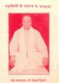
Sant Amardas Ji Kewal Hisar

References
- ↑ Subah of Delhi Ain-e-Akbari, by Abul Fazl, Vol II
- ↑ Jat Samaj, Agra : March 1998
- ↑ V. S. Agrawala: India as Known to Panini, 1953, p.498
- ↑ V. S. Agrawala: India as Known to Panini, 1953, p.54
- ↑ Ram Sarup Joon:History of the Jats/ChapterVIII,p.140
- ↑ Veerbhoomi Haryana/यौधेय गण की मुद्रायें (पृष्ठ 140-142)
- ↑ Aitihasik Sthanavali by Vijayendra Kumar Mathur, p.1026
- ↑ Aitihasik Sthanavali by Vijayendra Kumar Mathur, p.114
- ↑ Jat Jyoti:September 2013,p. 7
- ↑ Jat Jyoti:September 2013,p. 7
- ↑ Jat Jyoti:September 2013,p. 7
- ↑ Jat Gatha, 3/2016, p.30
Back to Jat Villages